Boucle Rocher St-Pierre – Bois de la Prise - Itinéraire de trail
Add to my favorites

Route opened
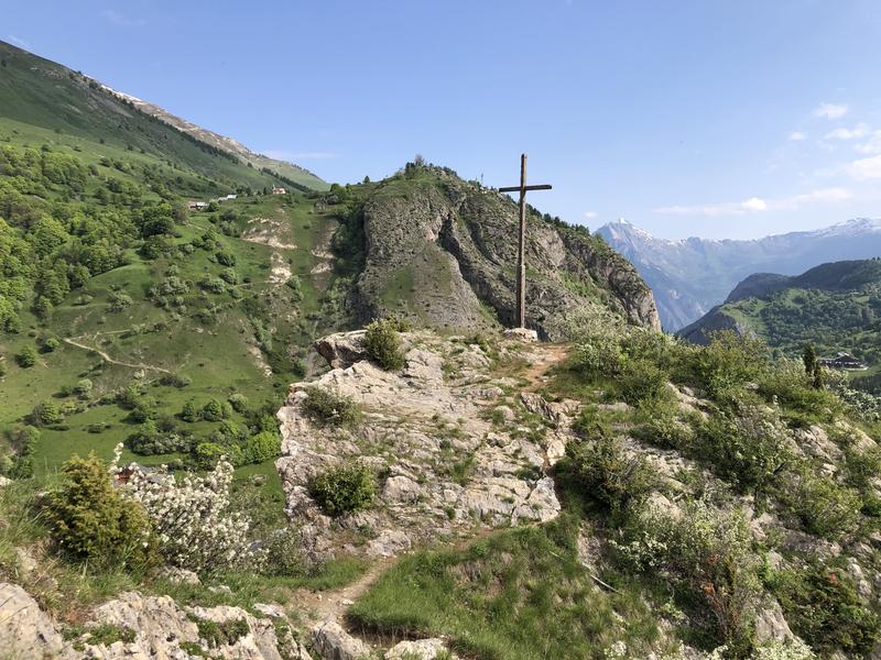
Take this loop around Valloire. Climb gradually to higher ground, passing by the fitness trail. Enjoy a lovely view from the top of St Pierre rock. Finish your outing at Les Villards, via the Bois de la Prise.
The characteristics of the route.

Office de tourisme de Valloire (73)
- Distance 10.36 km
- Elevation gain 400 m
- Elevation lost 400 m
- Min. elevation 1359 m
- Max. elevation. 1599 m
- Duration (depending on pace) 1h15
- Marking Yes
Marking : The trail is marked with yellow directional signs.Good plans : Your safety: - Bear in mind that you'll be riding in mountainous areas with sometimes technical trails, significant altitude differences and rapidly changing weather conditions. - Don't overestimate your abilities - Check the local weather forecast before setting off / www.meteofrance.com / tel: 3250 - Anticipate and adapt your clothing to the areas you'll be covering, and bring a survival blanket, windbreaker and whistle. - If you're going off on your own, be sure to provide those around you with information about your itinerary, and make sure you have a charged cell phone. - Always carry a supply of water. - Stay on marked paths. - Watch out for electric fences. - Make your presence known during hunting season (September to January) and in the vicinity of big game drives. - Help: in an emergency, call 112 Your environment : - Respect private property. - Don't light fires. - Keep your garbage and take it away. - Respect fruit crops and do not cross cultivated fields. - Don't frighten livestock. - Close park gates after passing through. Respect the direction of routes. Be careful and courteous when overtaking and crossing hikers.Admission fee : Free access.Opening : From 01/05 to 01/11 daily.
Subject to favorable snow and weather conditions.Step by step description : Departure point: Valloire Tourist Office.
1/ Take the rue des écoles on your left as you leave the Office and head towards the campsite.
2/ Before crossing the bridge, turn left and follow the path along the river.
3/ Follow the road to the start of the fitness trail, accessible via a footbridge on the left.
4/ Follow the path to the fitness trail, cross the equestrian center and continue uphill. Continue to follow the path on the left, then turn 180° onto a single which points to "Geneuil".
5/ This track descends to a large carriage track, on which you turn left in the direction of Chapelle St-Pierre.
6/ Continue to climb above the chapel before descending towards Carrefour Montagne.
7/ Go down rue de la bonne eau, past the campsite, then take the path on the left called "l'éco-sylve".
8/ Climb this track for 300m and, at the intersection, turn right towards Bois de la Prise.
9/ Continue on this track before rejoining the road and continuing towards Les Villards.
10/ Once you've reached Les Villards, take the track on the right and head back towards Valloire, with a final climb along the river before descending to the Tourist Office.
Report a problem
Website
Add your time and share your feelings
Services nearby

Le Contoir - Restaurant
Route des Villards

Le Contoir - Restaurant
Route des Villards

Valloire Tourist Office
Rue des Grandes Alpes

Notre Dame de l'Assomption Baroque Church
Place de l'église

Center de Soins ARNICA: health & well-being
Valloire


Information updated on 2025-06-24 by Office de Tourisme de Valloire


Follow us on
the digital trails
the digital trails





Valloire Tourist Office
210 rue des Grandes Alpes - 73450 Valloire
+33(0)4 79 59 03 96
Office de Tourisme
Contact mail
 Valloire Galibier Expériences - Parcours - Boucle Rocher St-Pierre – Bois de la Prise - Itinéraire de trail
Hello, world! This is a toast message.
Valloire Galibier Expériences - Parcours - Boucle Rocher St-Pierre – Bois de la Prise - Itinéraire de trail
Hello, world! This is a toast message.
Valloire Galibier Expériences - Parcours - Boucle Rocher St-Pierre – Bois de la Prise - Itinéraire de trail
Hello, world! This is a toast message.


OK
Annuler