Bonnenuit - Col du Galibier - Trail Itinerary
Add to my favorites

Caution! Zone of vigilance near the route
GRANDES ROUSSES - du 15/06/2026 au 15/10/2026 In progress
LA CHARMETTE - du 30/05/2026 au 20/10/2026 In progress
Route opened
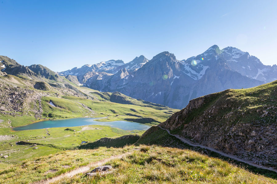
This route is a part of the Trail du Galibier route. Quite difficult, it is aimed at experienced trailers. You will be immersed in a majestic alpine environment and will pass by 3 high altitude lakes.
The characteristics of the route.

Office de Tourisme (73)
- Distance 28.15 km
- Elevation gain 1860 m
- Elevation lost 1860 m
- Min. elevation 1748 m
- Max. elevation. 2686 m
- Duration (depending on pace) 6h
- Marking No
To activate geolocation, click on the map icon.Admission fee : Free access.Opening : From 31/05 to 15/10 daily.
Subject to favorable weather.Step by step description : Departure from Hameau de Bonnenuit. 1- Follow the path up to Plan d'Orient. 2 - After descending the Col de la Paré, you cross the Rochilles military camp. 3- Skirt around the Grand Ban lakes and Lac Rond to pass over the Col des Cerces and return to Le Mottets (possibility of ending the circuit here and returning to Bonnenuit via Plan Lachat). 4- Descend via the 4x4 track before forking off onto a single on the left, a few metres after the small roadside chalet. 5 - Descend then climb back up to reach the Col du Galibier. 6 - From the Col du Galibier, start the descent to La Lauzette. 7 - Follow the path back to Bonnenuit.
Report a problem
Website
Add your time and share your feelings
Services nearby

La Poutre Restaurant
Bonnenuit

Les Réaux Gite
Chemin des Réaux

Tepee "L'insolite de Pierre Rouge"
Bonnenuit

Médiation par l'animal avec Husky en thérapie
601 chemin de Bonnenuit

Dog boarding You Ski en Terre Happy
601 chemin de Bonnenuit


Information updated on 2025-10-24 by Office de Tourisme de Valloire


Follow us on
the digital trails
the digital trails





Valloire Tourist Office
210 rue des Grandes Alpes - 73450 Valloire
+33(0)4 79 59 03 96
Office de Tourisme
Contact mail
 Valloire Galibier Expériences - Parcours - Bonnenuit - Col du Galibier - Trail Itinerary
Hello, world! This is a toast message.
Valloire Galibier Expériences - Parcours - Bonnenuit - Col du Galibier - Trail Itinerary
Hello, world! This is a toast message.
Valloire Galibier Expériences - Parcours - Bonnenuit - Col du Galibier - Trail Itinerary
Hello, world! This is a toast message.


OK
Annuler