Tour 35 Vers le Grand Fay
Add to my favorites

Route opened
Pleasant, shady and refreshing circuit which first goes along the Soanan river and then goes through the woods.
The characteristics of the route.
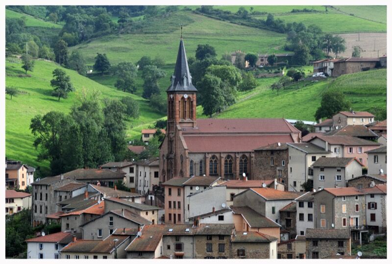
Valsonne (69)
- Distance 11 km
- Elevation gain 360 m
- Elevation lost 360 m
- Min. elevation 436 m
- Max. elevation. 766 m
- Duration (depending on pace) 2h50
- Marking Yes
After a big climb, enjoy a beautiful viewpoint at the Croix de la Main before arriving at Grand Fay, the highest point of the circuit. The descent then begins, and the return to the village is along the Langenève stream. On the way there and back, notice the Lavoir and the Chapelle Notre-Dame de la Pitié.
Average pace of 3.5km/h.Marking : Mark yellow with n°35 on a blue backgroundAdmission fee : Free access.
Average pace of 3.5km/h.Marking : Mark yellow with n°35 on a blue backgroundAdmission fee : Free access.
Area : Pays de Tarare
Report a problem
Website Roadbook on sale Gab69490
The 2022/08/04
En savoir plus
LISE44
finished in 02:45:00
The 2021/07/27
En savoir plus
Ajouter votre chrono et partager vos sensations
2022/08/04 Gab69490
Magnifique rando bien sportive sur le départ mais je recommande
2021/07/27 02:45:00
LISE44
LISE44
Magnifique rando du début jusqu'à la fin !! Très sportive, la montée tue les jambes mais ça vaut le coup !!!
2022/08/04 Gab69490
Magnifique rando bien sportive sur le départ mais je recommande
2021/07/27 02:45:00
LISE44
LISE44
Magnifique rando du début jusqu'à la fin !! Très sportive, la montée tue les jambes mais ça vaut le coup !!!
Services nearby

Auberge de la Vallée
Valsonne

Meublé "Le cocon" du Domaine de la rue de la tour
Valsonne

Les chambres du domaine de la Rue de la Tour
Valsonne
Le Gîte du Grand Peisselay
Valsonne
Gîte du Grand Peisselay 2
Valsonne


Information updated on 2021-08-20 by Office de Tourisme du Beaujolais Vert - Lac des sapins


Follow us on
the digital trails
the digital trails


![]()
Info & contacts
Office de Tourisme du Beaujolais Vert
Lac des Sapins - 69550 Cublize
04.74.89.58.03
accueil@beaujolaisvert.com
 Beaujolais Vert Pleine Nature - Parcours - Tour 35 Vers le Grand Fay
Hello, world! This is a toast message.
Beaujolais Vert Pleine Nature - Parcours - Tour 35 Vers le Grand Fay
Hello, world! This is a toast message.
Beaujolais Vert Pleine Nature - Parcours - Tour 35 Vers le Grand Fay
Hello, world! This is a toast message.


OK
Annuler