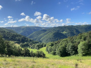
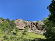
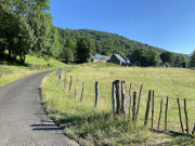
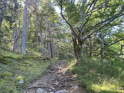
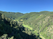
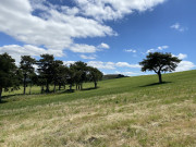
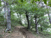
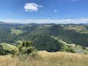
Log in
E-mail or username
Password
Login
Do you have
a Facebook or Apple account?
Don't have an account ?
Register
Forgot your password ?
Home
Routes
Useful informations
Mobile App
Trailrunning
Trailrunning
Voir la carte
MTB
Road bike
Itinerant routes
Hiking
Itinerant routes
Trailrunning
Défi Trail
routes
filtered
site(s)
filtered
Filters
Only my favorites
Delete filters
Around me :
< 5km
< 10km
< 25km
< 50km
Inactive
Difficulties :
Easy
Medium
Difficult
Expert
Durée :
<1h
1-2h
2-3h
3-4h
>4h
Distance (km) :
<10
10-25
25-50
50-75
>75
Distance (km) :
<25
25-50
50-100
100-150
>150
Elevation gain (m) :
<500
500-1000
1000-1500
1500-2500
>2500
Elevation lost (m) :
<500
500-1000
1000-1500
1500-2500
>2500
Tags :
Areas :
Circuit VTT n°18 - La chapelle
18.1km
480m
480m
Anzat-le-Luguet
Circuit VTT n°2 - Sur les hauteurs d'Issoire
20.4km
530m
530m
Issoire
Circuit VTT N°5 - Entre grottes et châteaux
40.5km
630m
630m
Issoire
Circuit VTT n°27 - Les gentianes
26.7km
810m
810m
Anzat-le-Luguet
Circuit VTT n°32 - Les grelettes
32.6km
940m
940m
Anzat-le-Luguet
Circuit VTT n°37 - Les Cheirs
38.3km
1130m
1130m
Anzat-le-Luguet
Circuit VTT n°7 - Sur la route des mines
8.4km
220m
220m
Brassac-les-Mines
Circuit VTT n°9 - Les rochers Montfaucons
25.9km
820m
820m
Champagnat-le-Jeune
Circuit VTT n°10 - Les portes du Livradois
40km
1250m
1250m
Jumeaux
Circuit VTT n°8 - Crêtes et vallées de Jumeaux
23.9km
720m
720m
Jumeaux
Circuit du Val d'Allier - Châteaux et villages au pays de la reine Margot (boucle cyclo n°7)
60.7km
1050m
1050m
Sauxillanges
La Grande Traversée du Massif Central à VTT (GTMC-VTT)
1412.3km
29240m
29480m
Avallon
Circuit VTT itinérant en 4 jours - Pays d'Issoire côté Cézallier
128.8km
3110m
3110m
Issoire
Circuit VTT itinérant en 2 jours - Pays d'Issoire côté Livradois
83.1km
1990m
1990m
Issoire
La Grande Traversée du Massif Central à VTT (GTMC) - Section Puy-de-Dôme en 5 jours
168.3km
4260m
3440m
Riom
La Chaubasse
9.6km
390m
390m
Saint-Floret
The gorges of Leyvaux and Apcher
11.8km
480m
480m
Anzat-le-Luguet
Around Montpeyroux – The walks of Léa and Tino
4.8km
170m
170m
Montpeyroux
Bard and Letz
9.5km
280m
280m
Madriat
Vodable and Colamine
11.2km
360m
360m
Mareugheol
The hills of Lempdes
9.4km
220m
220m
Moriat
The low crosses
6km
160m
160m
Chadeleuf
Between willows and pailhats – The walks of Léa and Tino
2.5km
110m
110m
Courgoul
The tour of the peak of Cluzel
8.6km
490m
490m
Courgoul
Sur les hauteurs de l'Alagnon
12.9km
500m
500m
Apchat
The Puy of Gourdon
10km
300m
300m
Ludesse
The five villages
13.5km
420m
420m
Saint-Cirgues-sur-Couze
The Valley of the Saints
5.7km
200m
200m
Boudes
The peak of Usson
10.8km
290m
290m
Saint-Rémy-de-Chargnat
Villeneuve, Boudes, Chalus
9.1km
350m
350m
Villeneuve
The limes
14.6km
310m
310m
Saint-Gervazy
Notre-Dame-De-Mailhat
8.6km
160m
160m
Nonette-Orsonnette
On the way to the arkose
8.5km
220m
220m
Montpeyroux
The lime and the wood of Jaby
10.3km
310m
310m
Mareugheol
The puy of Ysson
7.8km
270m
270m
Solignat
Clémensat
6.1km
220m
220m
Saint-Floret
The Puy of La Rodde
9.1km
340m
340m
Montaigut-le-Blanc
The Stone Fichade
6.2km
200m
200m
Champeix
The Puy des Plattes and the Bourgeassou
6.3km
230m
230m
Verrières
The Ravine of Quinsat
7.4km
280m
280m
Grandeyrolles
The Cellars of Saint-Julien
9.6km
270m
270m
Montaigut-le-Blanc
Apchat
10.5km
270m
270m
Ardes
From colliers to boatmen
9.4km
190m
190m
Brassac-les-Mines
The Peak of Brionnet
9.4km
390m
390m
Saurier
The Chapel of Roche-Charles
4.8km
190m
190m
Roche-Charles-la-Mayrand
The Plateau of Ussel
6.5km
210m
210m
Chassagne
The three valleys
17.5km
640m
640m
Champagnat-le-Jeune
The Chapel of Sainte-Pezade
7.4km
300m
300m
Mazoires
The Signal of the Luguet
13.7km
490m
490m
Anzat-le-Luguet
The hills and the lime
15.8km
380m
380m
Le Broc
Dauzat-sur-Vodable
10.2km
370m
370m
Ternant-les-Eaux
Pardines’s lime and Perrier’s caves
10.9km
290m
290m
Perrier
The Shepherds’ path
7.8km
470m
470m
Courgoul
The Chapel-sur-Usson
5.3km
200m
200m
La Chapelle-sur-Usson
The lime of Caure
11.8km
340m
340m
Augnat
Saint-Gervazy
9.5km
290m
290m
Vichel
The Cross of Auzat
12.5km
360m
360m
Auzat-la-Combelle
From fountains to washhouses
15.9km
600m
600m
Saint-Babel
The Valley of Parcelles
11.5km
210m
210m
Saint-Martin-des-Plains
The Valley of Civadoux
14.2km
590m
590m
Sauxillanges
The Puy of Lavelle
10.5km
390m
390m
Saint-Vincent
Saint-Jean-Saint-Gervais
15.8km
700m
700m
Jumeaux
The Citadel of Buron
10.9km
380m
380m
Parent
The Nonette hillock – The walks of Léa and Tino
3.1km
140m
140m
Nonette-Orsonnette
L’Éperon de Pierre-Ancize
9.9km
340m
340m
Saint-Yvoine
Le bois de la barre
6km
220m
220m
Anzat-le-Luguet
Entre béal et pigeonniers
10km
100m
100m
Saint-Germain-Lembron
Le bois de bord
12.9km
310m
310m
Sugères
Le moulin de la Rode
11.7km
360m
360m
Le Vernet-Chaméane
La ronde des suquets
12.2km
360m
360m
Saint-Étienne-sur-Usson
Le cirque d'Artout
7.6km
350m
350m
Anzat-le-Luguet
Variante Puy-de-Dôme du Tour des Vaches Rouges
74.8km
2180m
2180m
Ardes
Climbing site of the Rivalet
Verrières
Climbing site of Saurier
Saurier
Climbing site of Montpeyroux
Montpeyroux
Vernet lake
Le Vernet-Chaméane
Itinéraire canoë, descente de l'Allier en Pays d'Issoire
Issoire
The fishing site of the Couze of Ardes
Ardes
Fishing: No Kill In Chidrac
Chidrac
Fishing : The Artificial Lakes Of Mayeres
Issoire
Fishing: The Allagnon
Beaulieu
Fishing: autumn perches on the Allier River
Auzat-la-Combelle
Family fishing: the quays of Allier
Coudes
Passionate fishing: Le bourg
Saint-Vincent
Passionate fishing: place-called Veneix
Sauvagnat-Sainte-Marthe
Passionate fishing: the Cabane d'Oriol
Neschers
Passionate fishing: La Maille
Courgoul
Passionate fishing: the footbridge
Coudes
Passionate fishing: the Ribeyre
Courgoul
Passionate fishing: the Lion's Head
Saint-Floret
Passionate fishing: the Abyss
Saurier
Passionate fishing: the Volunteer Mill
Tourzel-Ronzières
Passionate fishing: the hell bridge
Neschers
Parcours pêche passion : le pont d'oriol
Coudes
Passionate fishing: the old mill
Montaigut-le-Blanc
Passionate fishing: the old village
Saint-Floret
Passionate fishing: the Gorges of Levas
Saurier
Passionate fishing: the gardens
Chidrac
Passionate fishing: Montemoi Peak
Saurier
Passionate fishing: Prada bridge
Champeix
Passionate and family fishing: the Croix Basses
Neschers
Passionate and family fishing: Perrache beach
Coudes
Fishing in family: artificial lake
Issoire
Site of paragliding of the Chapel of Brionnet
Saurier
Site Of Paragliding And Hang-Gliding Of The Peak Of Ysson
Vodable
Domaine de Parrot Nature
Anzat-le-Luguet
Route 1 - Notre-Dame du Mont Carmel
9.9km
380m
380m
Saurier
Route opened
Route 2 - Du Brionnet aux Pailhats de Courgoul
15.34km
569m
569m
Saurier
Route opened
Route 3 - Col de la Feuille - Pradelle
22.3km
1130m
1130m
Lomprat
Route opened
Circuit 4 - Les grottes de Jonas
19km
690m
690m
Lomprat
Route opened
Route 5 - Le Vernet - La Valette
13km
570m
570m
Valbeleix
Route opened
Route 6 - Du vallon de Valbeleix aux Gorges de Courgoul
30.91km
1572m
1572m
Valbeleix
Route opened
Route 7 - Verneuge - Courgoul - Auzolette
26km
1430m
1430m
Courgoul
Route opened
Route 8 - Tour du Pic de Cluzel
9.2km
580m
580m
Courgoul
Route opened
Route 9 - Tour des hameaux
46.1km
1920m
1920m
Courgoul
Route opened
Défi de Marqueriol
2.3km
410m
0m
Courgoul
Route closed
Défi de la Roche Nité
2.5km
360m
0m
Valbeleix
Route closed
Retour
FR
International
OpenStreetMap
OpenTopoMap
France
IGN Maps
Plan IGN
Plan IGN Vector Summer
IGN Aerial Imagery
OK
Annuler