
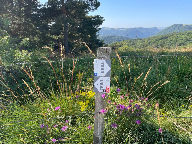
To help you find your way around, the Cœur d'Auvergne Espace Trail courses is equipped with trail markers. On each marker will be affixed the number(s) of the course to be followed on their difficulty colour (green - blue - red - black). The trail-running markers are placed in a regular way, at each directional change. Between two trail directional markers, follow the existing hiking markers.
You can also use the other available supports :
- GPX files
- PDF files
- Cœur d'Auvergne mobile app (soon available)
Before your run
- Check the weather forecast
- Find out about the state of the route and its opening
- Inform someone close to you of your itinerary and the planned timetables
- Take water and food and drink
On the routes, please :
- Use trails only during authorized periods and respect private property
- Stay on the paths and respect the natural and agricultural environments you pass through
- Close the barriers after you have passed through
- All parts of the route using public roads are subject to the Highway Code. Please make sure that you observe them.
- Keep all your rubbish with you.
A problem ? Report it ! In the event of problem (lack of markings, maintenance problems, environmental problems...), do not hesitate to signal this problem by using the reporting tool available on the route page, on the website (button under the map). You will be able to geolocate the problem and also send a corresponding photo. The Espace manager will be automatically notified of your report and will be able to check and deal with the problem.


Agglo Pays d'Issoire
Service Sport
04 15 62 20 00
![]()
Communauté de Communes du Massif du Sancy
Pôle de Pleine Nature
04 73 65 24 48
 Espace Trail Cœur d'Auvergne - Useful information

