Route 90 blue - Boucle du Château de Kerguéhennec
Add to my favorites

Route opened
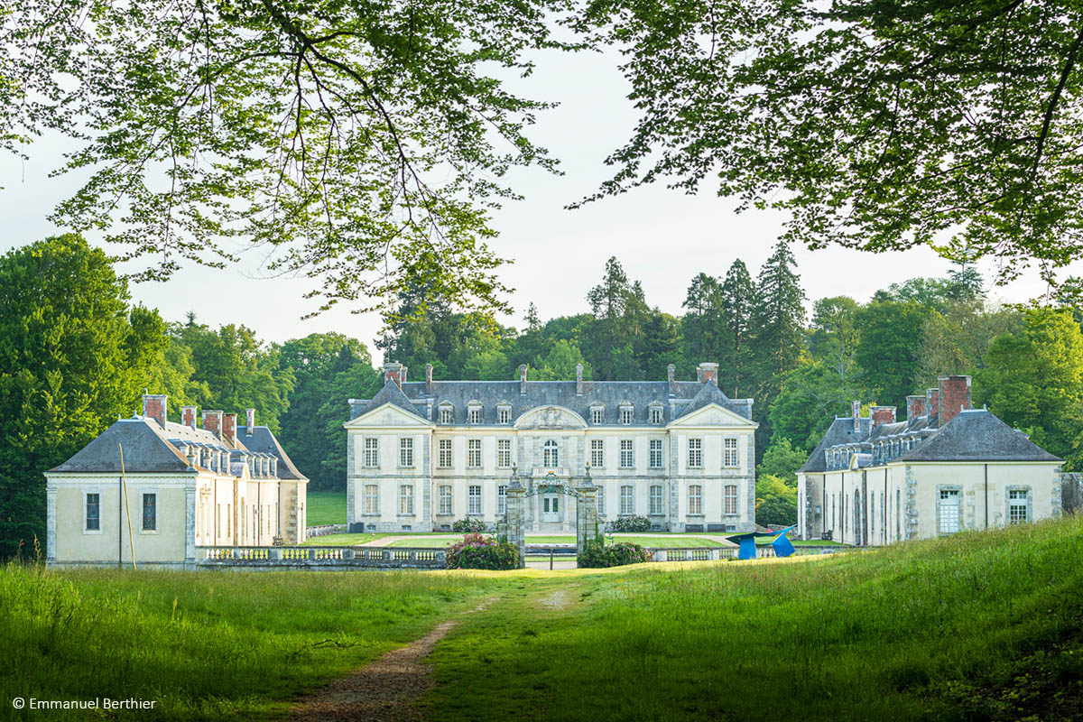
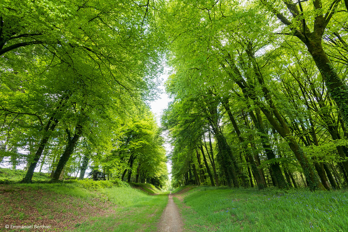
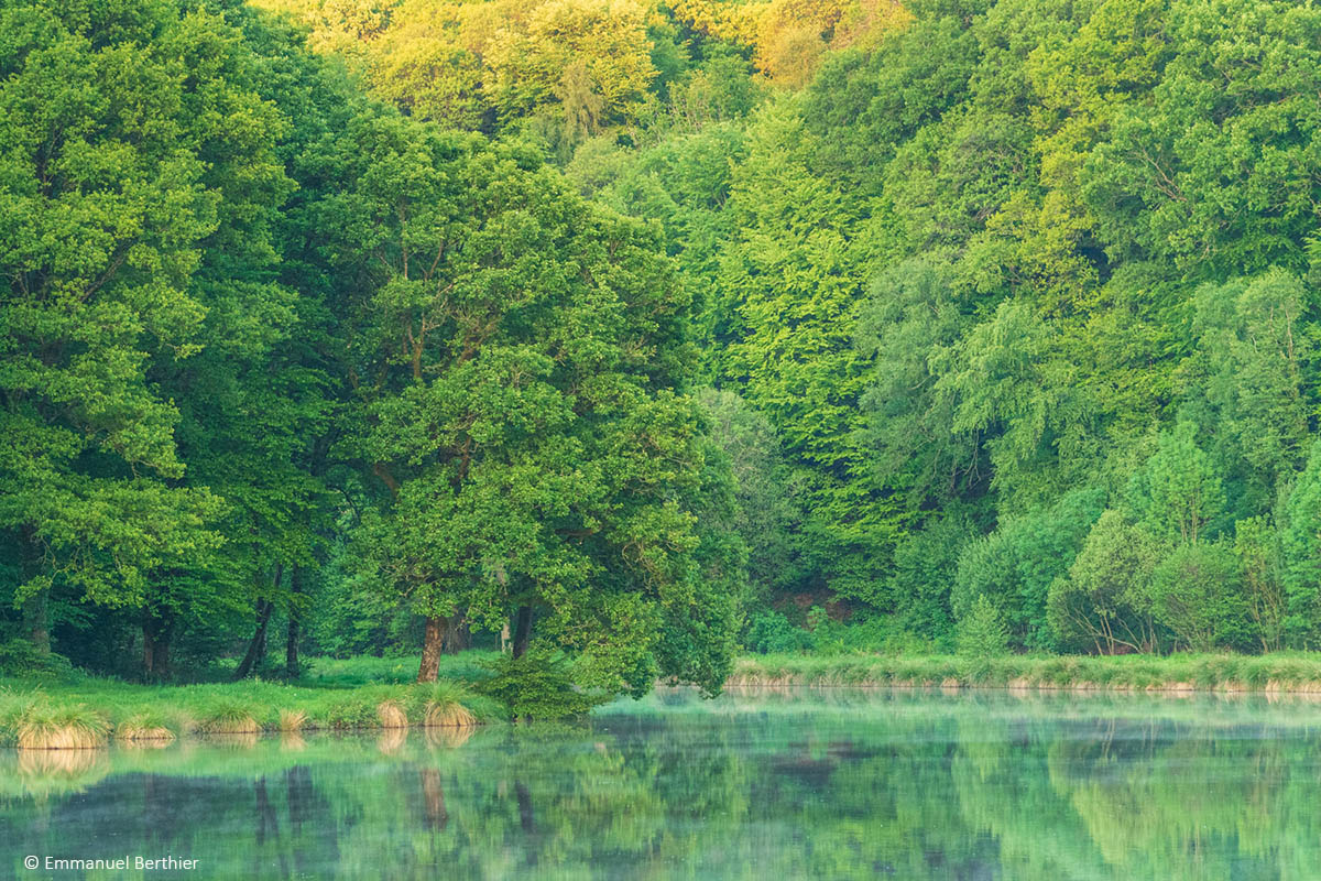
This circuit will take you on a succession of single tracks to discover the magnificent Keriolas valley, the village of Bignan and the exceptional setting of the castle and park of Kerguéhennec and its pond.
Warning : In order to limit the impact of the marking signs, this route is not specifically marked out trail. Follow the yellow hiking marking signs "circuit de Kerguéhennec".
The characteristics of the route.

Bignan (56)
- Distance 13.9 km
- Elevation gain 240 m
- Elevation lost 240 m
- Min. elevation 71 m
- Max. elevation. 126 m
- Duration (depending on pace) 1h20 à 2h40
- Marking follow hiking yellow signs

Get every route in your smartphone
The Cœur de Bretagne app allows you to find all the trail running, hiking, biking and horseriding trails on your smartphone, and much more!
A lot of features are in the app, including:
- geolocalisation on the route
- download data for offline access
- detailed IGN maps
- add your chrono on the route
- find the services nearby...

Add your time and share your feelings
Services nearby

Domaine de Kerguéhennec
Bignan

JVS Cycling
Locminé

Office de tourisme de Locminé
Locminé
Véloccasion 56
Moustoir-Ac

BREVEL'TRAIL
Saint-Jean-Brévelay


Follow us on
the digital trails
the digital trails


![]()
Infos & contact
Destination Coeur de Bretagne - Kalon Breizh
6 rue Joseph Pennec
22110 Rostrenen
Tel. +33(0)2 96 29 26 53
 Destination Cœur de Bretagne - Parcours - Route 90 blue - Boucle du Château de Kerguéhennec
Hello, world! This is a toast message.
Destination Cœur de Bretagne - Parcours - Route 90 blue - Boucle du Château de Kerguéhennec
Hello, world! This is a toast message.
Destination Cœur de Bretagne - Parcours - Route 90 blue - Boucle du Château de Kerguéhennec
Hello, world! This is a toast message.


OK
Annuler