Colonney circuit (n°3 Flaine)
Add to my favorites

Route closed
La haute montagne s’ouvre à vous. Circuit difficile avec des passages de vires, empruntant une crête parfois exposée (Tête des Lindars, Tête du Colonney). Point de vue à 380° sur la chaîne des Aravis, du Mont Blanc….Rencontre possible avec les bouquetins.
The characteristics of the route.

Flaine (74)
- Distance 6.6 km
- Elevation gain 560 m
- Elevation lost 560 m
- Min. elevation 2318 m
- Max. elevation. 2674 m
- Duration (depending on pace) 3h
- Marking yes
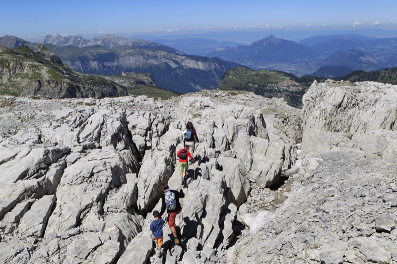
From Grandes Platières (viewpoint n°1), head towards “Refuge de Platé”. The path leads to the Col du Colonney via a succession of rocky projections and the deeply incised “Les Lapiaz” limestone plateaux. From this Col, follow the path that climbs steadily to the Tête des Lindars, then to the Tête du Colonney (viewpoint n°2). After having passed through a
stretch of Les Lapiaz, scree and patches of snow, this path continues up a majestic ridge with views over La Combe de Monthieu, glacial cirques and the Reliques du Colonney to the north, Les Forts de Platé to the south, and the vast Assy plateau below. Retrace your steps for the return journey.
Read before you go!
Circuit reserved for experienced hikers only.
Circuit reserved for experienced hikers only.
Area : Flaine
Report a problem 1 comment
Fiche PDF rando 3 Le Colonney
Add your time and share your feelings


Follow us on
the digital trails
the digital trails


![]()
Infos & contacts
Flaine Tourist Office
Tél. +33 (0)4 50 90 80 01
Les Carroz sports club
sports@aracheslafrasse.fr - Tél. +33 (0)4 50 90 24 80
Cluses Arve & montagnes Tourist Office
Tél. +33 (0)4 50 96 69 69


OK
Annuler