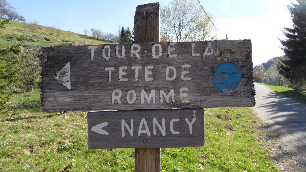
Tour de la Tête de Romme - Hiking
Add to my favorites

Route opened
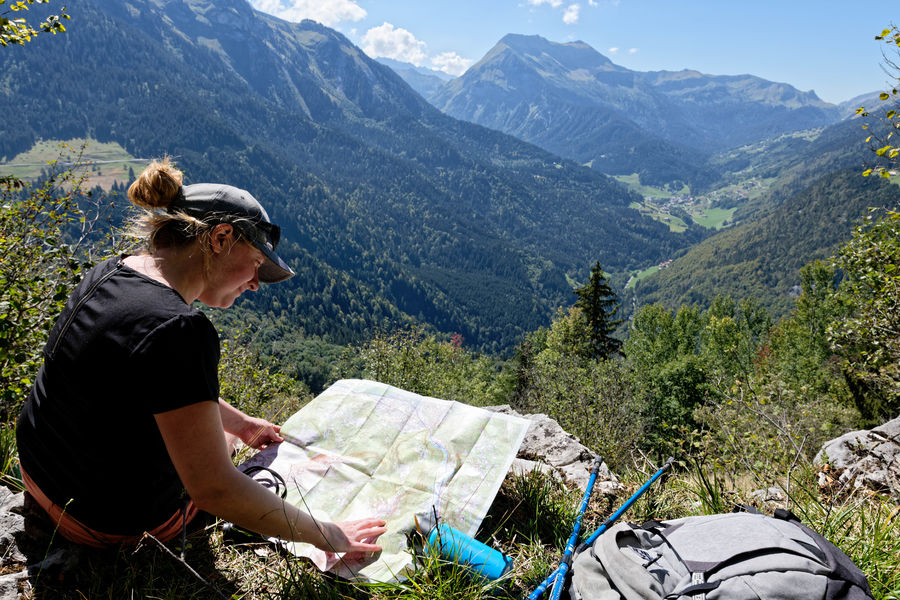
Walk to discover forest life and a hamlet like that of Romme. With a departure from the center of the village, this hike is accessible both in summer and in winter. Snowshoes are therefore recommended during snowfall.
The characteristics of the route.

Nancy-sur-Cluses (74)
- Distance 3.87 km
- Elevation gain 220 m
- Elevation lost 220 m
- Min. elevation 1291 m
- Max. elevation. 1411 m
- Duration (depending on pace) 1h20
- Marking Yes
Topo step by step : From the ski center to the forest: 20 minutes Cross the village to the chapel which is in the middle of the hamlet. At the chapel, follow the direction “Tour de Romme” to the right for 1 hour. The road goes up and passes by the restaurant "La Rebloche". 200 meters higher, take the road to the right at the intersection, then immediately take the path which departs to the left in the direction of "Tour de la Tête de Romme". The markup is then made of wood with blue paint. Cross the fields following the path. Before the forest, follow the direction to your right "Tour de la Tête de Romme par Charvet". Bypass of the Tête de Romme by Charvet : 20 minutes The path takes you into the forest and from there the climb becomes easier. The path will then turn left to go around the Tête de Romme and bypass this mountain. Follow the arrows in blue and the paint marks in blue and red on the trees. Enjoy the unobstructed view of the Cluses valley. At the next intersection continue the descent to the right following the indication "Tour de la Tête de Romme" (the trees are marked with the numbers 12-13). You are at a place called Barme Rousse. Return to the home by Les Sangles :40 minutes The descent then becomes steep for 300 meters to the next intersection. This is the main difficulty of this walk. Then follow the path indicated on the left "Tour de Romme by the Straps" (marking the tree with the number 14). The path is flat and climbs several times. Follow him ; it then becomes narrower and descends. You will have a beautiful view of the village of Le Reposoir before arriving at the top of the village of Romme. At the wooden post marked "Tour de Romme par les Sangles", continue straight across the fields to reach the village.Marking : Trail marked with directional posts (PDIPR)Equipments : Covered picnic area, Public WC, Picnic area, Admission fee : Free access. Topo rando on sale at the Tourist Office.Opening : From 01/04 to 15/11 daily.
Area : Cluses Arve & Montagnes
Report a problem
Website PDF map THIS ROUTE IN YOUR MOBILE PHONE
Download Flaine Carroz 2ccam Outdoor app
Get all the routes on your smartphone with Flaine Carroz 2ccam Outdoor app. You'll find a host of functions :
- Take advantage of detailed IGN maps
- Download data for consultation even when you're not connected to the network
- Geolocate yourself at any time on the route and altimeter profile
- Activate the off-track alarm to be alerted if you stray from the itinerary
- Find nearby services
- Share your experience (add a report, share your lap time)...

Add your time and share your feelings


Information updated on 2026-04-27 by Cluses Arve & montagnes Tourisme


Follow us on
the digital trails
the digital trails


![]()
Infos & contacts
Flaine Tourist Office
Tél. +33 (0)4 50 90 80 01
Les Carroz sports club
sports@aracheslafrasse.fr - Tél. +33 (0)4 50 90 24 80
Cluses Arve & montagnes Tourist Office
Tél. +33 (0)4 50 96 69 69
 Espace Trail Flaine - Les Carroz - Cluses Arve et Montagnes - Parcours - Tour de la Tête de Romme - Hiking
Hello, world! This is a toast message.
Espace Trail Flaine - Les Carroz - Cluses Arve et Montagnes - Parcours - Tour de la Tête de Romme - Hiking
Hello, world! This is a toast message.
Espace Trail Flaine - Les Carroz - Cluses Arve et Montagnes - Parcours - Tour de la Tête de Romme - Hiking
Hello, world! This is a toast message.


OK
Annuler