Loop of Les Rochers de Leschaux - Hike
Add to my favorites

Route closed
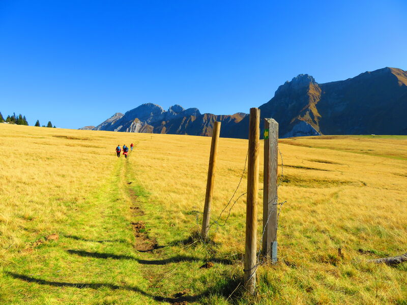
A hike starting from Mont-Saxonnex requiring good physical condition. The route is long but not difficult on the technical side. At the top, a nice panorama awaits you on the Jalouvre.
The characteristics of the route.

Mont-Saxonnex (74)
- Distance 11.73 km
- Elevation gain 690 m
- Elevation lost 690 m
- Min. elevation 1492 m
- Max. elevation. 1916 m
- Duration (depending on pace) 4h
- Marking Yes
Step-by-step guide : From les Frachets to Col de Cenise: 25 min. Start on the path which goes along the farm of Frachets. You will have to cross the patures toward the Cross Felay. From there, follow the path. From Col de Cenise ti Rochers de Leschaux: 1h20 Keep going toward les Rochers de Leschaux. Cross the grass et go alog the rocks until you can read Les Rocherss de Leschaux. Then, the path is made of Lapiaz (specific rockes in the mountains.) The Cross if the final point of the hike. From Plateau de Solaison to Col de Cenise: 1h05 Once you reach the Plateau de Solaison, go toward Grotte de la Glacière. Be careful, the path may be sliperry. Once yu reach the Perthuis, walk toward the Col de Cenise. then, tak ethe direction of le Grand-Bornand until le Col de Cenise.From les Frachets to Col de Cenise: 25 min. Start on the path which goes along the farm of Frachets. You will have to cross the patures toward the Cross Felay. From there, follow the path. From Col de Cenise ti Rochers de Leschaux: 1h20 Keep going toward les Rochers de Leschaux. Cross the grass et go alog the rocks until you can read Les Rocherss de Leschaux. Then, the path is made of Lapiaz (specific rockes in the mountains.) The Cross if the final point of the hike. From Plateau de Solaison to Col de Cenise: 1h05 Once you reach the Plateau de Solaison, go toward Grotte de la Glacière. Be careful, the path may be sliperry. Once yu reach the Perthuis, walk toward the Col de Cenise. then, tak ethe direction of le Grand-Bornand until le Col de Cenise.Equipments : Free car park, Car park, Admission fee : Free access.Opening : Closed temporarily.
Area : Cluses Arve & Montagnes
Report a problem
Website PDF map
Add your time and share your feelings


Information updated on 2026-04-29 by Cluses Arve & montagnes Tourisme


Follow us on
the digital trails
the digital trails


![]()
Infos & contacts
Flaine Tourist Office
Tél. +33 (0)4 50 90 80 01
Les Carroz sports club
sports@aracheslafrasse.fr - Tél. +33 (0)4 50 90 24 80
Cluses Arve & montagnes Tourist Office
Tél. +33 (0)4 50 96 69 69
 Espace Trail Flaine - Les Carroz - Cluses Arve et Montagnes - Parcours - Loop of Les Rochers de Leschaux - Hike
Hello, world! This is a toast message.
Espace Trail Flaine - Les Carroz - Cluses Arve et Montagnes - Parcours - Loop of Les Rochers de Leschaux - Hike
Hello, world! This is a toast message.
Espace Trail Flaine - Les Carroz - Cluses Arve et Montagnes - Parcours - Loop of Les Rochers de Leschaux - Hike
Hello, world! This is a toast message.


OK
Annuler