Grand Serre au Taillefer running tour
Add to my favorites

Caution! Zone of vigilance near the route
It´s a great challenge to reach the top of Taillefer which is 2857 m high. Please Keep in mind that you are in a very rich but fragile area. We recommend you to stay on the main trail and not cross wetlands, in order to not create other paths.
The characteristics of the route.
Alpe Du Grand Serre (38)
- Distance 34.6 km
- Elevation gain 2700 m
- Elevation lost 2700 m
- Min. elevation 1124 m
- Max. elevation. 2854 m
- Marking No
This is the best : higher running route of all trail running stations, with its highest point at Taillefer's summit, 2857m high.
This high montain running tour should not be done with bad weather.
You can divide the tour and stop at the station right after the Grand Serre climbing, as a little red level tour. You can also getting down at the Pas de la Mine, avoiding the last tour to the Taillefer summit.
You can either go straight from the station to the Taillefer, it is a red level tour as well. If you make it all, it is a black level tour.
There are some dizzying part in the last loop from the Pas de la Mine to the summit of Taillefer : you need to be used to trail running. 50m before the Pas de la Mine, take the little path on your right side, marks are there (sometimes without N°3), but the path may have only little trace.
Cairns and white and blue traces guide you, please pay attention to them, especially the Lemay lake area that you have to bypass on the left bank.
O
nce at the pass, it is a return-trip to the top on the same way. Please mind your steps on the little path following the ridge on the way back.
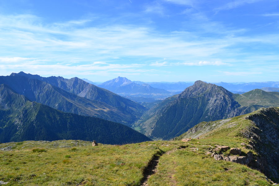
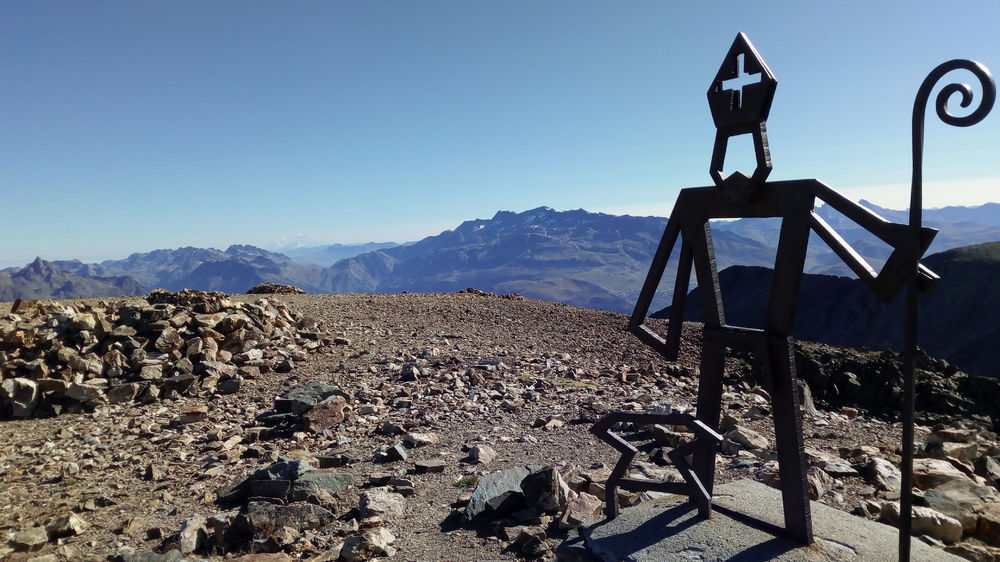
On your way, you'll find amazing view points, from Grand Serre dizzying ridge, in the climb to Taillefer, to end to an absolutely breathtaking panorama from the top of the Taillefer, over all Grenoble and Valbonnais region, as well as Oisans, Ecrins, Belledonne, Chartreuse and Vercors ranges.Equipments : Play area, Picnic area, Bar, Toilets, Public WC, Car park, Restaurant, Admission fee : Free access. Free pricing rundown at the tourist office.Opening : From 01/05 to 31/10. Depending on the snow cover.
This high montain running tour should not be done with bad weather.
You can divide the tour and stop at the station right after the Grand Serre climbing, as a little red level tour. You can also getting down at the Pas de la Mine, avoiding the last tour to the Taillefer summit.
You can either go straight from the station to the Taillefer, it is a red level tour as well. If you make it all, it is a black level tour.
There are some dizzying part in the last loop from the Pas de la Mine to the summit of Taillefer : you need to be used to trail running. 50m before the Pas de la Mine, take the little path on your right side, marks are there (sometimes without N°3), but the path may have only little trace.
Cairns and white and blue traces guide you, please pay attention to them, especially the Lemay lake area that you have to bypass on the left bank.
O
nce at the pass, it is a return-trip to the top on the same way. Please mind your steps on the little path following the ridge on the way back.
On your way, you'll find amazing view points, from Grand Serre dizzying ridge, in the climb to Taillefer, to end to an absolutely breathtaking panorama from the top of the Taillefer, over all Grenoble and Valbonnais region, as well as Oisans, Ecrins, Belledonne, Chartreuse and Vercors ranges.Equipments : Play area, Picnic area, Bar, Toilets, Public WC, Car park, Restaurant, Admission fee : Free access. Free pricing rundown at the tourist office.Opening : From 01/05 to 31/10. Depending on the snow cover.
Area : Matheysine
Report a problem
Pdf file Features of the application :
- Location and orientation on detailed maps thanks to the GPS of your smartphone
- Description of routes and points of interest on the route
- Photo gallery by route
- Detailed elevation profile
- Route tracking alert to warn you if you stray from the route
- Send predefined messages by SMS to your contacts
- Emergency module: trigger a call or send an emergency SMS in case of problem
- Agenda: access to events organized in the department
- News: find in the application the latest news on the web portal
- Adding achievements
- Add reports in case of problems encountered on the routes
- Share on social networks
Add your time and share your feelings
Services nearby

Alpe du Grand Serre Tourist Office
Alpe Du Grand Serre

Belvédère Olivier Messiaen
Saint-Théoffrey

Romanche Museum
Livet-et-Gavet
Arselle Peatbog (Preserved Natural Area)
Chamrousse
Museum of the French Revolution
Vizille


Information updated on 2021-09-25 by Matheysine Tourisme


Follow us on
the digital trails
the digital trails


![]()
The Isère Outdoor application was created
by the Département de l'Isère
Infos & contact
Conseil départemental de l'Isère
7 rue Fantin Latour
CS 41096
38 022 Grenoble cedex 1
Tel. 04 76 00 38 38
 Isère Outdoor - Parcours - Grand Serre au Taillefer running tour
Hello, world! This is a toast message.
Isère Outdoor - Parcours - Grand Serre au Taillefer running tour
Hello, world! This is a toast message.
Isère Outdoor - Parcours - Grand Serre au Taillefer running tour
Hello, world! This is a toast message.


OK
Annuler