Route n°4 - Sainte Calixte
Add to my favorites

Outdoor trails under the responsibility of the participant: find out about the conditions and equip yourself accordingly.
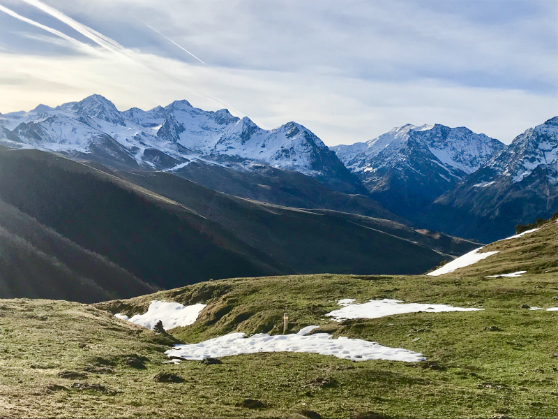
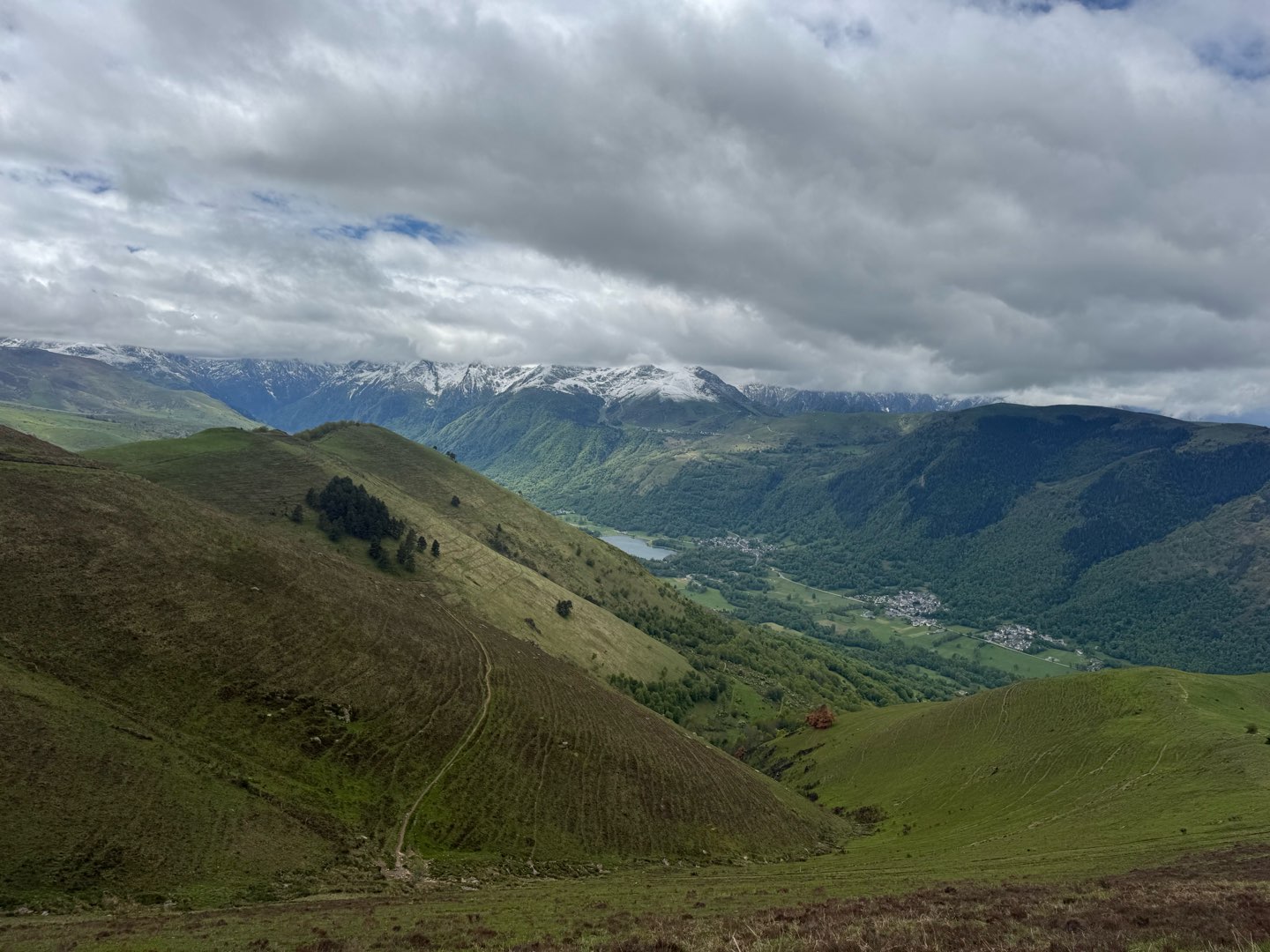
Very nice run starting from Loudenvielle. This loop is perfect to take height and enjoy the landscape. The trails are not very technical and despite its distance the route remains accessible. Admire the Landscape! The passage over the ridges allows a 360° view of the valley. The descent is gentle and allows you to start again at the end of the course. Enjoy the lake view from the castle of Génos to finish your outing.
The characteristics of the route.

Loudenvielle (65)
- Distance 23.96 km
- Elevation gain 1120 m
- Elevation lost 1120 m
- Min. elevation 930 m
- Max. elevation. 1835 m
- Duration (depending on pace) 3h à 6h
- Suivre le balisage Trail-running n°4 red

The latest reviews & times
Tontontony
The 2026/05/16
En savoir plus
Fred_runner
finished in 02:40:00
The 2026/04/17
En savoir plus
Toutoune85
finished in 03:03:07
The 2024/08/13
En savoir plus
quercy-outdoor-admin
The 2024/02/26
En savoir plus
TotoG
The 2024/02/10
En savoir plus
See all reviews & times
2026/04/17 02:40:00
Fred_runner
Fred_runner
Parcours très joli, alternance de roulant et de petits singles tech.
Attention le parcours est noté ouvert mais la descente orientée NE entre le sommet de Cap de Tuquet et le fond du vallon, au dessus du bois de Joannerous est encore bien enneigée (50cm) au 17/04.
J’ai fait demi tour pour récupérer un sentier plus bas au départ du point 1729 carte IGN.
2024/08/13 03:03:07
Toutoune85
Toutoune85
Belle sortie, promesses tenues, de jolies panorama sur le lac de Loudanvielle, des belles rencontres dans les pâturages, et des décors qui changent régulièrement. Partir avec une trace GPX, il n'y a pas assez de balisages !!!
2024/02/26 Quercy Outdoor
Jolie trace mais balisage quasi inexistant, montre gps ou appli indispensable. Chemins du sommet enneigés du coup progression très difficile.
2024/02/10 TotoG
Très jolie parcours, très varié entre les chemins, les routes, les prés etc.. Prolongé jusqu’au Pic du lion pour un total de 32km en 4h45! Des supers spots photo en plus!!! Attention aux balisages, il en manquait beaucoup… J’ai suivi mon parcours sur l’appli qui m’a aidé plus d’une fois.
À part ça à refaire sans hésité !!
2023/04/18 nathouw
Très joli parcours que l'on peut rallonger en poussant jusqu'au pic du Lion à 2 km environ, soit un total de 30 km pour 1400 de D+ environ. En revanche, le balisage mérite d'être plus précis, les panneaux ne sont pas toujours en place ou pas très visibles. Il est impératif de partir avec la trace sur sa montre ou sur une appli. Sur la fin, pas retrouvé non plus les panneaux du circuit 4, j'ai suivi les 2, 3, 6 je crois. Sinon un bon parcours relativement roulant, peu difficile et qui permet de faire une bonne séance d'endurance trail.
2023/04/18 nat70
Joli trace mais il manque quelques panneaux on a un peu jardinet …. On a pris de la hauteur on a poussé jusqu’au pic du Lion pour avoir un panorama vers le luchonnais vu sur le lac de Bareille Magnifique à refaire
Services nearby

Wellness Sport Camping Loudenvielle
Loudenvielle

INTERSPORT Loudenvielle
Loudenvielle

L'Ardoise
Loudenvielle
L'Escapade
Loudenvielle

Louron Valley Visitor Center
Loudenvielle


Follow us on
the digital trails
the digital trails


![]()
Info & contacts
Intercommunal Association of the Louron Valley
contact@louronbikeandtrail.fr
Tel. +33 (0)5 62 99 95 35
 Louron Bike & Trail - Parcours - Route n°4 - Sainte Calixte
Hello, world! This is a toast message.
Louron Bike & Trail - Parcours - Route n°4 - Sainte Calixte
Hello, world! This is a toast message.
Louron Bike & Trail - Parcours - Route n°4 - Sainte Calixte
Hello, world! This is a toast message.


OK
Annuler