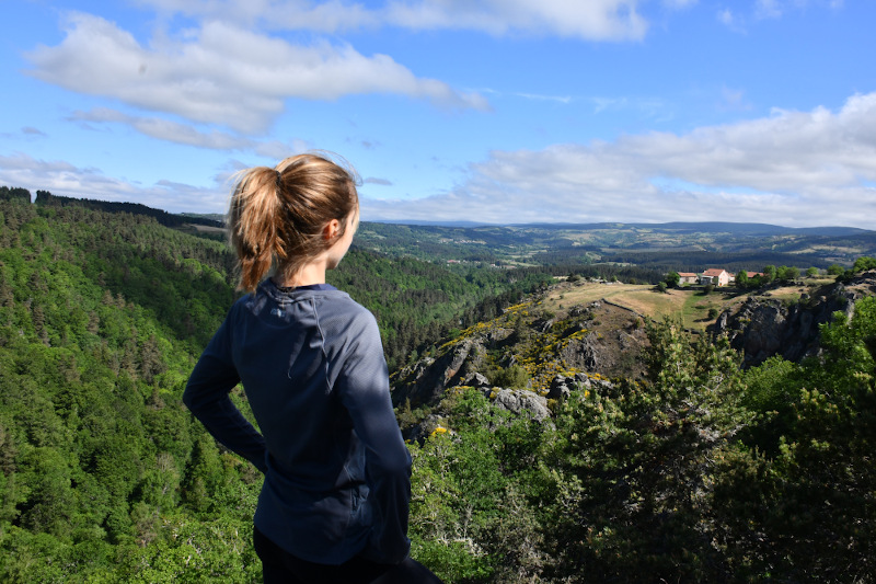
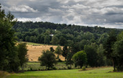
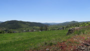
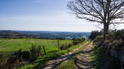
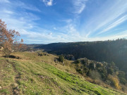
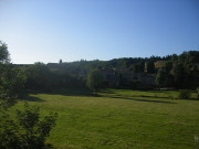
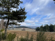
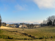
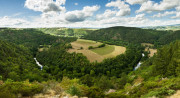
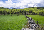
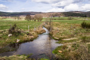
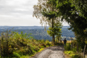
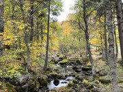
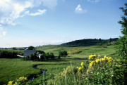
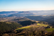
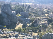
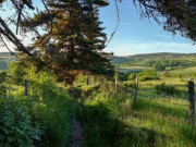
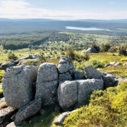
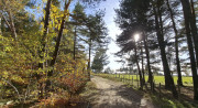
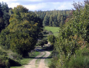
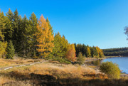
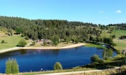
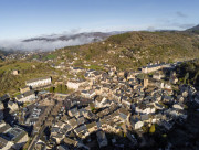
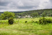
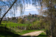
Margeride

a wild and mystical territory
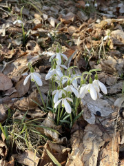
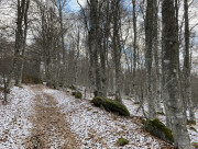
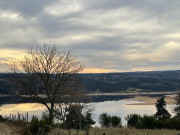
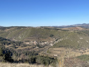
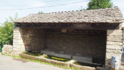
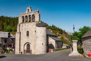
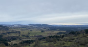
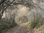
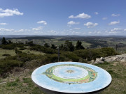
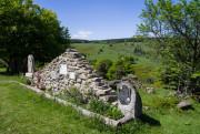
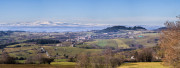
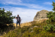
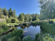
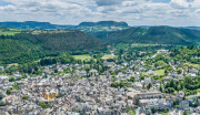
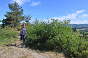
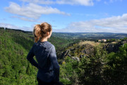
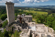
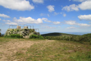
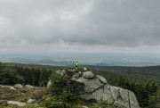
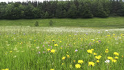
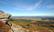
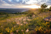
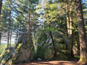
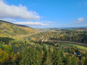
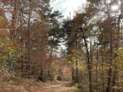
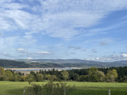
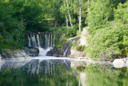
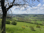
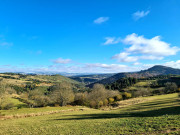
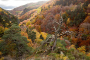
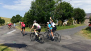
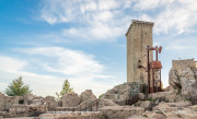
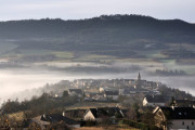
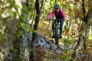
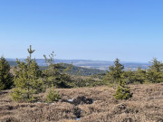
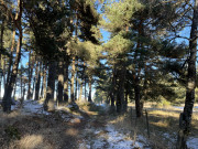
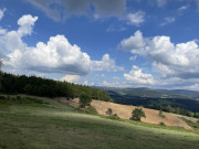
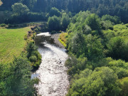
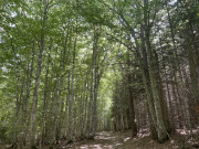
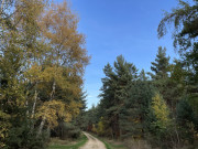
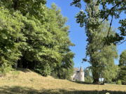
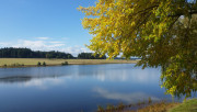
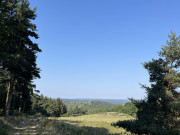
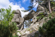
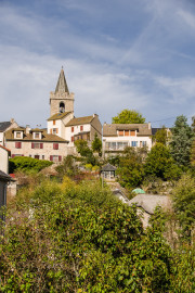
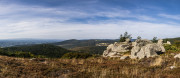
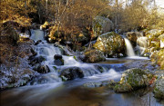
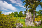
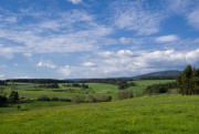
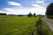
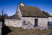
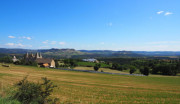
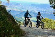
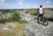
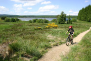
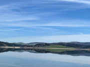
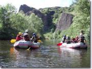
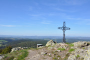
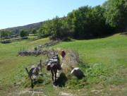
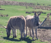
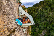
A land of legend, the Margeride is the largest granite massif in Europe. Its wild and unspoiled nature makes it an ideal destination for lovers of preserved open spaces. Famous for having been the setting of the legendary Beast of Gévaudan, this land still retains all its mystery today.
Our favorites:
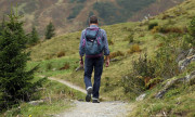
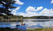
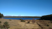
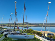
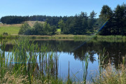
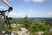
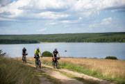
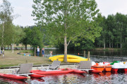
- Trying a kitesurfing or wingfoil session on Lac de Naussac;
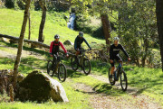
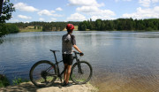
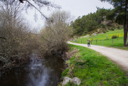
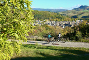
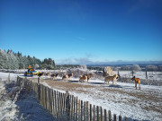
- Ski touring or mountain biking around Lac de Charpal;
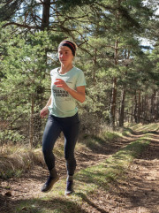
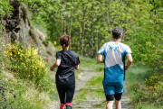
- Running the “Trails en Margeride” events;
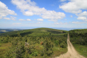
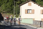
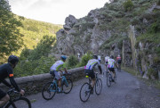
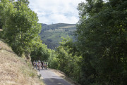
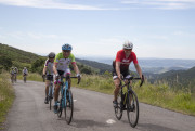
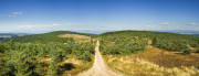
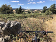
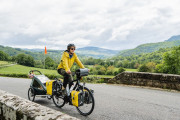
- Riding the Grande Traversée du Massif Central by mountain bike or gravel
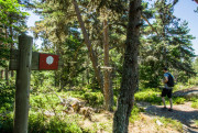
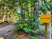
Outdoor activities on this area


routes filtered
Only my favorites
Delete filters
Around me :
< 5km
< 10km
< 25km
< 50km
Inactive
Difficulties :
Easy
Medium
Difficult
Expert
Durée :
<1h
1-2h
2-3h
3-4h
>4h
Distance (km) :
<10
10-25
25-50
50-75
>75
Distance (km) :
<25
25-50
50-100
100-150
>150
Elevation gain (m) :
<500
500-1000
1000-1500
1500-2500
>2500
Elevation lost (m) :
<500
500-1000
1000-1500
1500-2500
>2500
Tags :
Areas :
Montrodat - Le Mazet
4.68km 70m 70m
Parking du Centre d'Education Motrice de Montrodat
Route opened
4.68km 70m 70m
Parking du Centre d'Education Motrice de Montrodat
Route opened

Le plateau du Poujoulet
7.11km 190m 190m
Esplanade de l'Europe
Route opened
7.11km 190m 190m
Esplanade de l'Europe
Route opened
Pied d'Escure
14.58km 420m 420m
Parking du Centre d'Education Motrice de Montrodat
Route opened
14.58km 420m 420m
Parking du Centre d'Education Motrice de Montrodat
Route opened
La Porte des Fées - Parcours n°13
9.48km 270m 270m
Place du Foirail, Le Malzieu-Ville
Route opened
9.48km 270m 270m
Place du Foirail, Le Malzieu-Ville
Route opened
Le plateau de la Cham
2.11km 20m 20m
Parking du plateau de la Cham
Route opened
2.11km 20m 20m
Parking du plateau de la Cham
Route opened

Grazières et le pont des Cayres - Parcours n°28
8.33km 180m 180m
Parking du Breuil, Saint-Alban-sur-Limagnole
Route opened
8.33km 180m 180m
Parking du Breuil, Saint-Alban-sur-Limagnole
Route opened
Le sentier des Chazelles
8.08km 230m 230m
Parking devant la salle des fêtes de Montrodat
Route opened
8.08km 230m 230m
Parking devant la salle des fêtes de Montrodat
Route opened
Sur les pas de saint Loup
6.98km 230m 230m
Devant la mairie de Recoules-de-Fumas
Route opened
6.98km 230m 230m
Devant la mairie de Recoules-de-Fumas
Route opened
At the start of the Gorges
4.59km 170m 170m
Pomeyrols (Naussac-Fontanes)
Route opened
4.59km 170m 170m
Pomeyrols (Naussac-Fontanes)
Route opened
Circuit de l'Evêque
5.85km 140m 140m
Place du village de Cheylard l'Evèque
Route opened
5.85km 140m 140m
Place du village de Cheylard l'Evèque
Route opened
Les balcons du Lac
4.79km 120m 120m
Fontanes (Naussac-Fontanes)
Route opened
4.79km 120m 120m
Fontanes (Naussac-Fontanes)
Route opened

Le sentier des Fées
3.29km 50m 50m
La baraque de St Flour de Mercoire
Route opened
3.29km 50m 50m
La baraque de St Flour de Mercoire
Route opened
Tour du Causse de Montgros
5.8km 130m 130m
Montgros (St Bonnet de Montauroux)
Route opened
5.8km 130m 130m
Montgros (St Bonnet de Montauroux)
Route opened

La Combe-Crose - Parcours n°5
8.91km 210m 210m
Lieu-dit Brassac, Saint-Chély-d'Apcher
Route opened
8.91km 210m 210m
Lieu-dit Brassac, Saint-Chély-d'Apcher
Route opened
Le Marlet - Parcours n°23
8.81km 200m 200m
Lajo
Route opened
8.81km 200m 200m
Lajo
Route opened
Les Tourbières de Lajo - Parcours n°22
4.65km 180m 180m
Lajo
Route opened
4.65km 180m 180m
Lajo
Route opened

La Tour d'Apcher depuis Civergols - Parcours n°7
10.72km 230m 230m
Lieu-dit Civergols, Saint-Chely-d'Apcher
Route opened
10.72km 230m 230m
Lieu-dit Civergols, Saint-Chely-d'Apcher
Route opened

Le Puech Meyro
7.9km 150m 150m
Parking devant la fontaine
Route opened
7.9km 150m 150m
Parking devant la fontaine
Route opened

Les berges de la Truyère - Parcours n°25
7.39km 140m 140m
Lieu-dit Les Estrets, Fontans
Route opened
7.39km 140m 140m
Lieu-dit Les Estrets, Fontans
Route opened
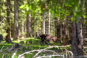
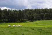
Les bisons de Margeride - PR n°26
8.79km 210m 210m
Sainte-Eulalie
Route opened
8.79km 210m 210m
Sainte-Eulalie
Route opened
Partage des eaux
10.13km 190m 190m
Laubert
Route opened
10.13km 190m 190m
Laubert
Route opened
La Butte de Verdezun - Parcours n°11
7.52km 160m 160m
Place du Foirail, Le Malzieu-Ville
Route opened
7.52km 160m 160m
Place du Foirail, Le Malzieu-Ville
Route opened

Le tour du Rouchat
4.96km 170m 170m
Centre village de Fabrèges (commune d'Antrenas) - Parking en face de l'ancienne école
Route opened
4.96km 170m 170m
Centre village de Fabrèges (commune d'Antrenas) - Parking en face de l'ancienne école
Route opened
Plot de la fage
8.98km 210m 210m
Laubert
Route opened
8.98km 210m 210m
Laubert
Route opened
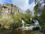
La cascade du Franquet - Parcours n°29
10.2km 210m 210m
Château de Saint-Alban-sur-Limagnole
Route opened
10.2km 210m 210m
Château de Saint-Alban-sur-Limagnole
Route opened
Le Vallon de Sarroul - Parcours n°3
7.34km 130m 130m
Parking du Pontet, Saint-Chély-d'Apcher
Route opened
7.34km 130m 130m
Parking du Pontet, Saint-Chély-d'Apcher
Route opened
Les drailles de la Boulaine
10.08km 290m 290m
Parking de la salle des fêtes
Route opened
10.08km 290m 290m
Parking de la salle des fêtes
Route opened
Le Vallon du Rouchat - Parcours n°6
10.12km 220m 220m
Place de l'église, Rimeize
Route opened
10.12km 220m 220m
Place de l'église, Rimeize
Route opened
Le Plateau de La Chan - Parcours n°17
13.61km 270m 270m
Saint-Léger-du-Malzieu
Route opened
13.61km 270m 270m
Saint-Léger-du-Malzieu
Route opened
Circuit de la Reisse
6.47km 180m 180m
Pont d'Allier de Langogne
Route opened
6.47km 180m 180m
Pont d'Allier de Langogne
Route opened
Bel Air
8.16km 190m 190m
Saint Symphorien
Route opened
8.16km 190m 190m
Saint Symphorien
Route opened
La Chapelle St Roch - Parcours n°30
15.58km 410m 410m
Le Rouget, Saint-Alban-sur-Limagnole
Route opened
15.58km 410m 410m
Le Rouget, Saint-Alban-sur-Limagnole
Route opened
Le chemin du Bouchet
5.88km 300m 300m
Parking de la salle des fêtes de Saint-Léger de Peyre
Route opened
5.88km 300m 300m
Parking de la salle des fêtes de Saint-Léger de Peyre
Route opened
Les Terrasses de la Truyère - Parcours n°12
7.48km 280m 280m
Parking de la Mairie - face garage automobile, Blavignac
Route opened
7.48km 280m 280m
Parking de la Mairie - face garage automobile, Blavignac
Route opened
Circuit du Langouyrou
7.2km 130m 130m
Langogne, pré de la Foire
Route opened
7.2km 130m 130m
Langogne, pré de la Foire
Route opened

Du Gévaudan au Velay
8.85km 270m 270m
Place au Monument
Route opened
8.85km 270m 270m
Place au Monument
Route opened
Le Puech-del-Mont - Parcours n°10
17.3km 310m 310m
Parking du Pontet, Saint-Chély-d'Apcher
Route opened
17.3km 310m 310m
Parking du Pontet, Saint-Chély-d'Apcher
Route opened
Le cirque de Paladines - Parcours N° 21
11.24km 330m 330m
Chaulhac
Route opened
11.24km 330m 330m
Chaulhac
Route opened

La Croix Blanche
9.02km 220m 220m
Place de l'église de Rocles
Route opened
9.02km 220m 220m
Place de l'église de Rocles
Route opened
La tour d'Apcher depuis le Malzieu-Ville - Parcours n°20
13.86km 280m 280m
Place du Foirail - Le Malzieu-Ville
Route opened
13.86km 280m 280m
Place du Foirail - Le Malzieu-Ville
Route opened
Ferluguet - Parcours pédestre n°27
13.97km 320m 320m
Sainte-Eulalie
Route opened
13.97km 320m 320m
Sainte-Eulalie
Route opened
Mialanes - Les Ducs - Parcours n°14
10.92km 360m 360m
Mialanes, Le Malzieu-Forain
Route opened
10.92km 360m 360m
Mialanes, Le Malzieu-Forain
Route opened
Le Chandaison
14.02km 350m 350m
Parking du Pontet - Saint-Chély-d'Apcher
Route opened
14.02km 350m 350m
Parking du Pontet - Saint-Chély-d'Apcher
Route opened
Circuit de l'Art Sacré
16.73km 340m 340m
Chastanier
Route opened
16.73km 340m 340m
Chastanier
Route opened
Notre Dame de Beaulieu - PR n°19
18.28km 560m 560m
Place du village, Paulhac en Margeride
Route opened
18.28km 560m 560m
Place du village, Paulhac en Margeride
Route opened
Entre balcons et hameaux - Parcours n°15
11.9km 350m 360m
Place de l'église, Saint Privat du Fau
Route opened
11.9km 350m 360m
Place de l'église, Saint Privat du Fau
Route opened
Le Mont Mouchet - Parcours N° 16
13.03km 380m 380m
Place du village, Paulhac en Margeride
Route opened
13.03km 380m 380m
Place du village, Paulhac en Margeride
Route opened
Le Truc de Chapelat - Parcours n°18
13.73km 520m 520m
Montchabrier, Le Malzieu-Forain
Route opened
13.73km 520m 520m
Montchabrier, Le Malzieu-Forain
Route opened
Chante-Perdrix
23.39km 520m 520m
Place du Foirail à Grandrieu
Route opened
23.39km 520m 520m
Place du Foirail à Grandrieu
Route opened
La Croix de Parpaillon
11.18km 330m 330m
Place du village d'Auroux
Route opened
11.18km 330m 330m
Place du village d'Auroux
Route opened


Follow us on
the digital trails
the digital trails


![]()
The Lozère Outdoor application was created
by the Lozère Department
Infos & contacts
Conseil départemental de la Lozère
sportsnature@lozere.fr
+33(0)4 66 49 66 32
Crédits photos
 Lozère Outdoor - Margeride

