
A gentle trail that lets you admire the marvellous panoramic views of the Mont Lozère uplands.

- Distance 16.9 km
- Elevation gain 330 m
- Elevation lost 330 m
- Min. elevation 1412 m
- Max. elevation. 1699 m
- Duration (depending on pace) 1h45
- Suivre le balisage Yes

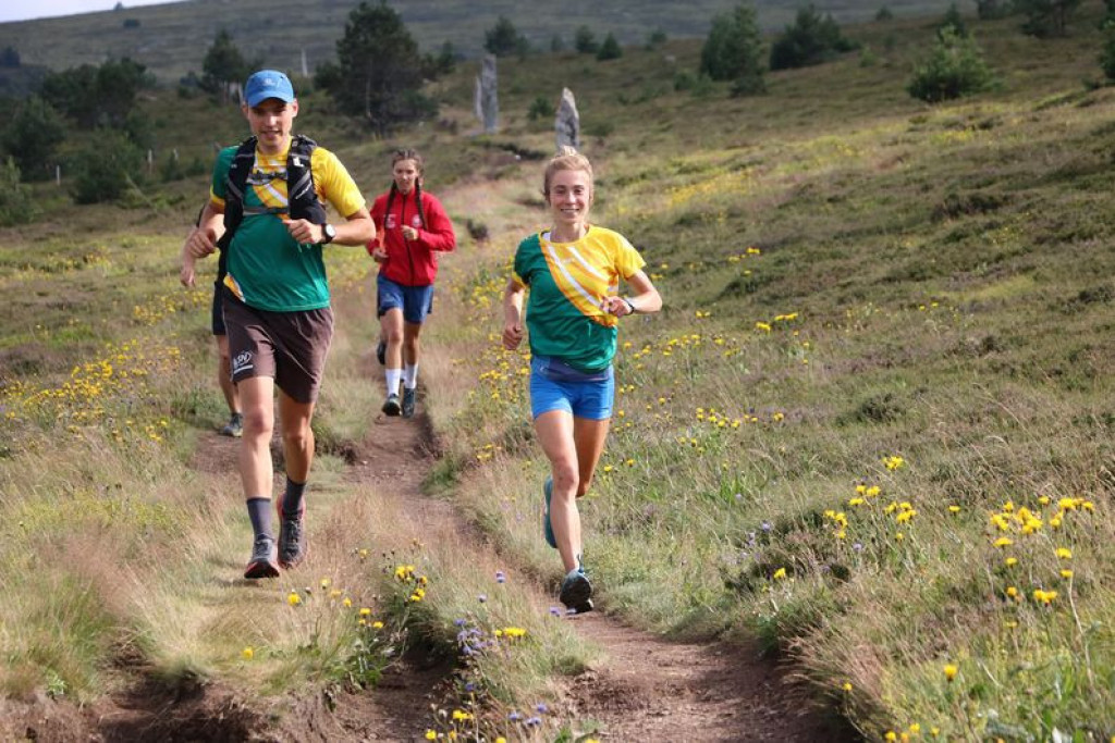
A short steep climb to start with, then a more runnable track for six kilometres. Take the time to enjoy the panoramic views from the ridge.
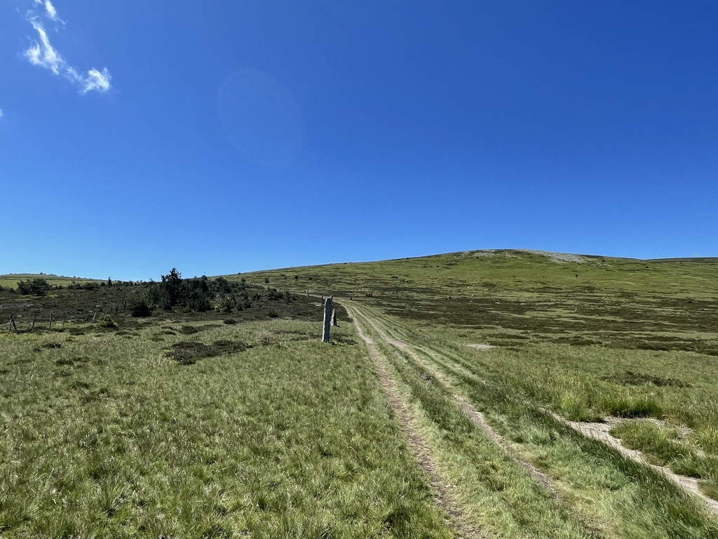
Next a section on a pleasant path between pines and broom that finishes with a steeper stretch to reach the summit. Time for photos – and windcheaters!
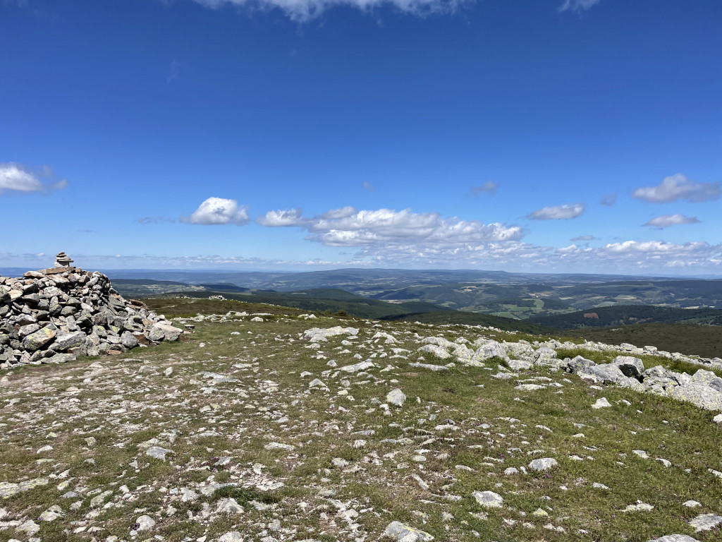
A stroll on the ridge, then an enjoyable descent on the GR®70 long-distance hiking path, punctuated by mythical cairns.
Follow the waymarks for trail #14.
Signposts will guide you all along this route, as well as yellow painted waymarks. In the description below, the signposted place names and/or directions are given in bold italics between quotation marks:
Starting from "Station du Mont-Lozère", head for "Parking des Chômeurs" via :
- "La Chapelle du Mont Lozère".
- At "Parking des Chômeurs", go to "Sous le Signal des Laubies" via :
- "Route des Chômeurs".
- At "Sous le Signal des Laubies", head for "Sommet de Finiels" via :
- "La route forestière des crêtes".
- At "Sommet de Finiels", return to "La Station du Mont-Lozère" via :
- "Col de la draille", then "Parking des chômeurs", "La chapelle du Mont-Lozère".
This trail is taken from the guidebook Mont Lozère – Pays des sources, published by the Pôle de pleine nature du mont Lozère.
Parking : Station du Mont Lozère
Attention présence possible de chien(s) de protection (patou-s) sur le secteur, adaptez votre comportement.
Avant de vous engager sur un circuit, vérifiez qu'il est adapté à votre activité et à votre niveau. N'oubliez pas que le temps change vite en montagne. Refermez bien les clôtures et les portillons. Restez sur les chemins balisés.
Get all the routes on your smartphone with the Lozère outdoor app. You'll find all outdoor activities (summer and winter seasons) and a host of functions :
- Take advantage of detailed IGN maps
- Download data for consultation even when you're not connected to the network
- Geolocate yourself at any time on the route and altimeter profile
- Activate the off-track alarm to be alerted if you stray from the itinerary
- Share your experience (add a report, share your lap time)...


the digital trails


![]()
The Lozère Outdoor application was created
by the Lozère Department
Infos & contacts
Conseil départemental de la Lozère
sportsnature@lozere.fr
+33(0)4 66 49 66 32
Crédits photos
 Lozère Outdoor - Parcours - Mont Lozère in a nutshell, Trail #14
Lozère Outdoor - Parcours - Mont Lozère in a nutshell, Trail #14
Lozère Outdoor - Parcours - Mont Lozère in a nutshell, Trail #14
Lozère Outdoor - Parcours - Mont Lozère in a nutshell, Trail #14
Lozère Outdoor - Parcours - Mont Lozère in a nutshell, Trail #14

