logo
Welcome to Espace Trail Pays des Aiguilles d'Arves

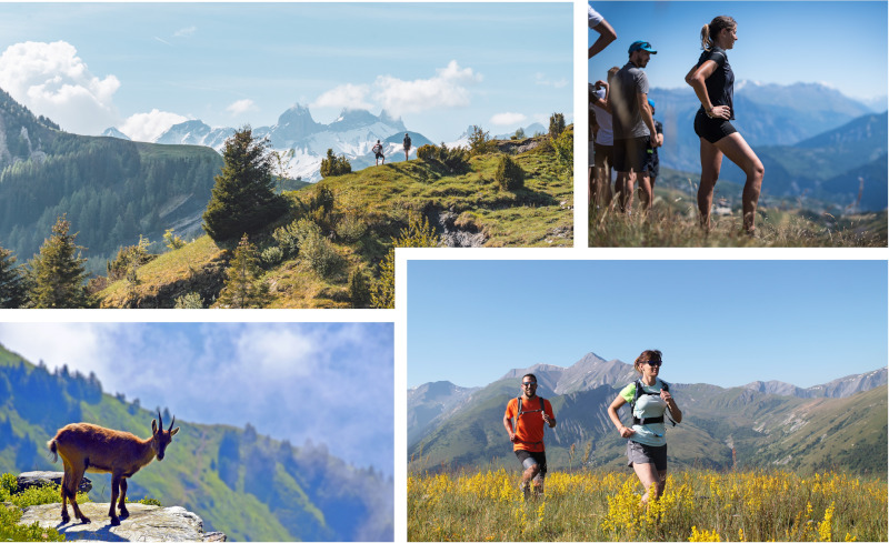
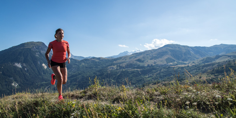
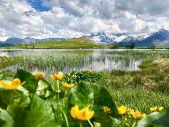
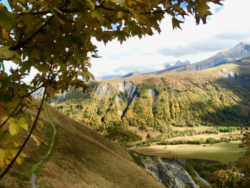
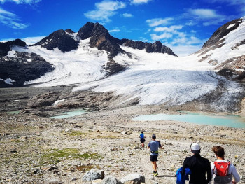
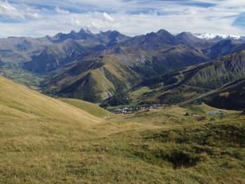
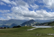
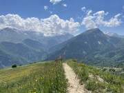
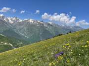
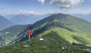
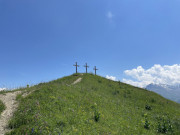
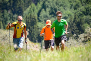
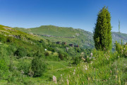
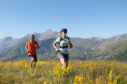
Come and discover about 550 kilometres of waymarked trailrunning routes in the heart of our mountains. Whether you're a beginner or an expert, you'll find something to suit you, with routes ranging from 3 kilometres in the valley or beside the lake, to 38 kilometres and over 2,300 metres of ascent! For a variety of pleasures and landscapes, explore our trails from Saint-Sorlin-d'Arves, Saint-Jean-d'Arves, la Toussuire, le Corbier and the Valley of Villards.

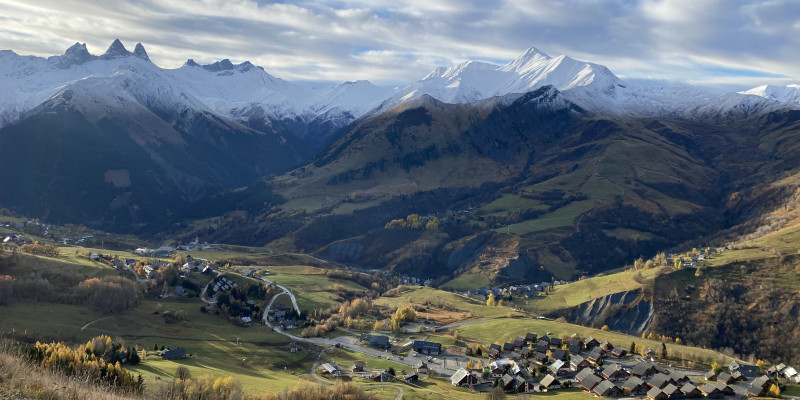
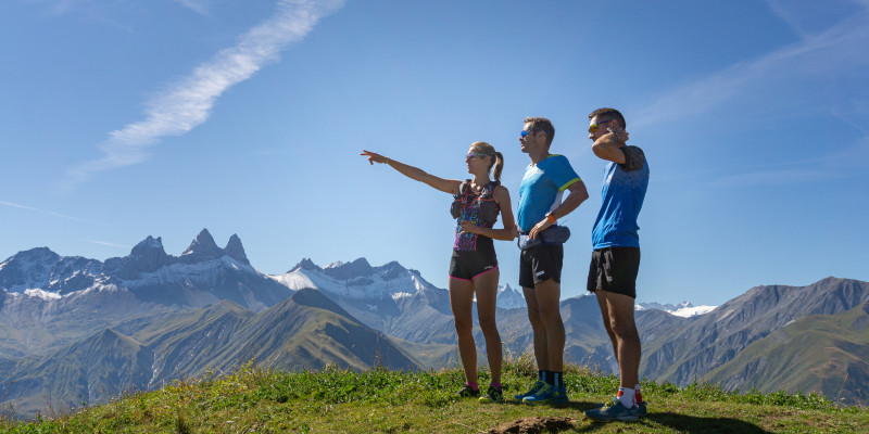
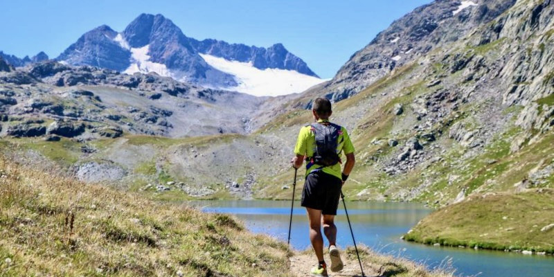
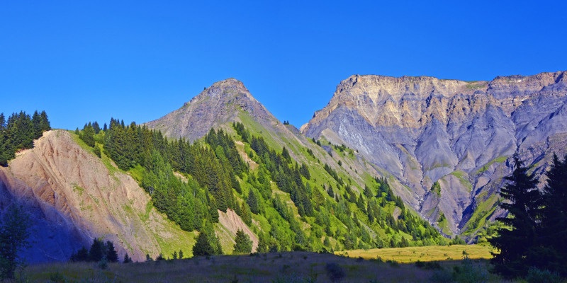
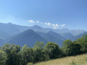
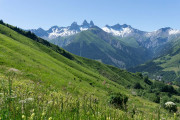
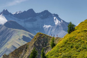
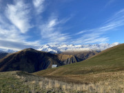
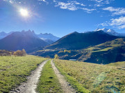
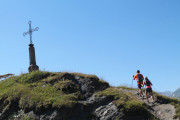
From the villages and resorts, head up to the ridges and summits for unbeatable views of the Aiguilles d'Arves and the surrounding mountains. From lakes to glaciers, come and run through high mountain scenery and immerse yourself in a wild and authentic world, via legendary passes such as the Col de la Croix de Fer.

Discover territories
La Toussuire
A mountain of memories
View more
Cœur de Maurienne - Col du Chaussy
The heart of the valley
View more
Le Corbier - Villarembert
90 km of playground
View more
Saint Jean d'Arves
Destination emotions
View more
Saint Sorlin d’Arves - Col de la Croix de Fer
Pure sport
View more
Vallée des Villards
Wild and authentic
View more
Discover the routes
See in full screen
routes filtered
Only my favorites
Delete filters
Around me :
< 5km
< 10km
< 25km
< 50km
Inactive
Difficulties :
Easy
Medium
Difficult
Expert
Durée :
<1h
1-2h
2-3h
3-4h
>4h
Distance (km) :
<10
10-25
25-50
50-75
>75
Distance (km) :
<25
25-50
50-100
100-150
>150
Elevation gain (m) :
<500
500-1000
1000-1500
1500-2500
>2500
Elevation lost (m) :
<500
500-1000
1000-1500
1500-2500
>2500
Tags :
Areas :
Route n°1 - Marcrozet
3.5km 140m 140m
Saint-Sorlin-d’Arves
Route closed
Dogs on leash allowedDiscoveringWith the familyIn the forest
Route n°2 - The small lakes
3.3km 120m 120m
Saint-Sorlin-d’Arves
Route closed
Dogs on leash allowedWith the familyLakePanoramic view
Route n°3 - Roche Noire
11km 650m 650m
Saint-Sorlin-d’Arves
Route closed
Dogs on leash allowedLocal wildlifeHeritageOn the ridgesPanoramic view
Route n°4 - Glacier
16.4km 850m 850m
Saint-Sorlin-d’Arves
Route closed
Dogs on leash allowedGlacierLake
Route n°5 - Les Sanières
5.1km 390m 390m
Saint-Sorlin-d’Arves
Route closed
Dogs on leash allowedHeritagePanoramic view
Route n°6 - L'Ouillon
14.9km 1130m 1130m
Saint-Sorlin-d’Arves
Route closed
Dogs on leash allowedLakeHeritagePanoramic view
Route n°7 - Trail de l'Etendard
21.8km 1530m 1530m
Saint-Sorlin-d’Arves
Route closed
Dogs on leash allowedLakePanoramic view
Route n°9 - Les Crêtes
37.8km 2280m 2280m
Saint-Sorlin-d’Arves
Route closed
Dogs on leash allowedLakeHeritagePanoramic view
Route n°10 - Verticale de la Croix de Fer
3.2km 550m 0m
Saint-Sorlin-d’Arves
Route closed
Dogs on leash allowedVertical
Route n°11 - Verticale de l'Ouillon
5.3km 920m 10m
Saint-Sorlin-d’Arves
Route closed
Dogs on leash allowedVerticalPanoramic view
Route n°20 : Champ l'Eriscal
5.1km 190m 190m
La Toussuire
Route closed
DiscoveringWith the family
Route n°21 : Champ l'Eriscal - Les Trois Croix - La Rochette
9.7km 480m 480m
La Toussuire
Route closed
Discovering
Route n°22 : Croix de Coin Cavour - Le Grand Truc
13.7km 910m 910m
La Toussuire
Route closed
On the ridgesPanoramic view
Route n°23 : Boucle de l'Ouillon
23.5km 1510m 1510m
La Toussuire
Route closed
On the ridgesPanoramic view
Parcours n°24 - Boucle des hameaux
13.5km 780m 780m
Fontcouverte-la Toussuire
Route opened
Heritage
Route n°25 - Fontcouverte - La Toussuire
34.2km 2150m 2150m
La Toussuire
Route closed
On the ridgesPanoramic view
Route n°30 - Le Col d'Arves
6.6km 390m 390m
Le Corbier
Route opened
Panoramic view
Route n°31 - Champlong - Plan Chaud
7.7km 380m 380m
Le Corbier
Route opened
Route n°32 - Col d'Arves - Plan Chaud
11.2km 610m 610m
Le Corbier
Route opened
HeritagePanoramic view
Route n°33 - Col d'Arves - Villarembert - La Toussuire
16km 840m 840m
Le Corbier
Route closed
HeritagePanoramic view
Route n°34 - Col d'Arves - Crêtes de l'Ouillon - Grand Truc - La Toussuire
23.7km 1460m 1460m
Le Corbier
Route closed
On the ridgesPanoramic view
Parcours n°35 - Mont Charvin - Pointe du Corbier - Saint-Sorlin - l'Ouillon
30.6km 2380m 2380m
Le Corbier
Route closed
On the ridgesPanoramic view
Route n°40 - Boucle des 2 cols
4.5km 310m 310m
Saint-Jean-d'Arves
Route closed
Panoramic view
Route n°41 - De Saint Jean d’Arves à Saint Sorlin d’Arves en balcon
8.9km 450m 450m
Saint-Jean-d'Arves
Route closed
Discovering
Route n°42 - De Saint Jean d’Arves au Corbier par les cols
10.9km 670m 670m
Saint-Jean-d'Arves
Route closed
Panoramic view
Route n°43 - De Saint Jean d’Arves à Saint Sorlin d’Arves par les cols
18.1km 1130m 1130m
Saint-Jean-d'Arves
Route closed
Panoramic view
Parcours n°50 - Croix des Charrières
9.8km 380m 380m
Saint-Colomban-des-Villards
Route closed
DiscoveringIn the forestHeritage
Route n°51 - Valmaure - Mont Rond - Combe des roches
14.5km 860m 860m
Saint-Colomban-des-Villards
Route closed
Route n°52 - Combe des roches - Balmettes - Saint Alban des Villard
22.4km 1640m 1640m
Saint-Colomban-des-Villards
Route closed
Route n°53 - Verticale du Grand Truc
6.7km 1150m 40m
Saint-Colomban-des-Villards
Route closed
Vertical
Route n°60 - KV du Chaussy
6.5km 1020m 0m
La Tour-en-Maurienne - Montvernier
Route opened
In the forestCanyonVertical
Route n°61 - Double KV du Grand Coin
12.5km 2220m 20m
La Tour-en-Maurienne - Montvernier
Route opened
Local wildlifeOn the ridgesVerticalPanoramic view
Route n°62 - Tour de l'Armélaz
14.9km 1110m 1110m
La Tour-en-Maurienne - Montvernier
Route opened
In the forest
Route n°63 - Tour de l'Armélaz et Combe de l'Indrion
22.1km 1840m 1840m
La Tour-en-Maurienne - Montvernier
Route opened
In the forestLocal wildlifePanoramic view
Route n°64 - Grande Boucle
31.9km 2580m 2580m
La Tour-en-Maurienne - Montvernier
Route opened
Local wildlifeHeritagePanoramic view
Route n°65 - L'Atelier de Fontaine Froide
2.7km 250m 250m
La Tour-en-Maurienne
Route opened
In the forestSpecific trainingPanoramic view
Route n°66 - Croix de la Chal
5.6km 310m 310m
La Tour-en-Maurienne
Route opened
With the familyIn the forestPanoramic view
Route n°67 - Combe de l'Indrion
7.6km 760m 760m
La Tour-en-Maurienne
Route opened
Local wildlifePanoramic view
Parcours n°68 - Boucle du Grand Coin
16km 1310m 1310m
La Tour-en-Maurienne
Route opened
Local wildlifeOn the ridgesPanoramic view
Route n°69 - Boucle d'Hermillon
6.6km 570m 570m
La Tour-en-Maurienne
Route opened
With the familyIn the forest
Route n°70 - Boucle de Montandré
8.9km 750m 750m
Saint-Jean-de-Maurienne
Route opened
With the familyIn the forest
Route n°71 - Jarrier VK
4.7km 1030m 10m
Saint-Jean de Maurienne / Jarrier
Route opened
In the forestVerticalPanoramic view
The most popular routes
randotrail
Parcours n°63 - Tour de l'Armélaz et Combe de l'Indrion
22.1 km
randotrail
Parcours n°50 - Croix des Charrières
9.8 km
randotrail
Parcours n°68 - Boucle du Grand Coin
16 km
randotrail
Parcours n°52 - Combe des roches - Balmettes - Saint Alban des Villard
22.4 km
randotrail
Parcours n°21 : Champ l'Eriscal - Les Trois Croix - La Rochette
9.7 km
Photos of the territory
They took up the challenge ! And you ?
npozo
finished in 02:51:52
Parcours n°30 - Le Col d'Arves
The 2024/08/21
Marcelultimate47
finished in 03:44:25
Parcours n°4 - Glacier
The 2024/07/24
Gaubai
finished in 00:42:02
Parcours n°5 - Les Sanières
The 2023/07/09
Erwantregouet
finished in 04:05:16
Parcours n°7 - Trail de l'Etendard
The 2022/08/09
RUNFOREVER
finished in 01:44:00
Parcours n°3 - Roche Noire
The 2022/07/24

OK
Annuler