La Pointe des Follys
Add to my favorites

Route closed

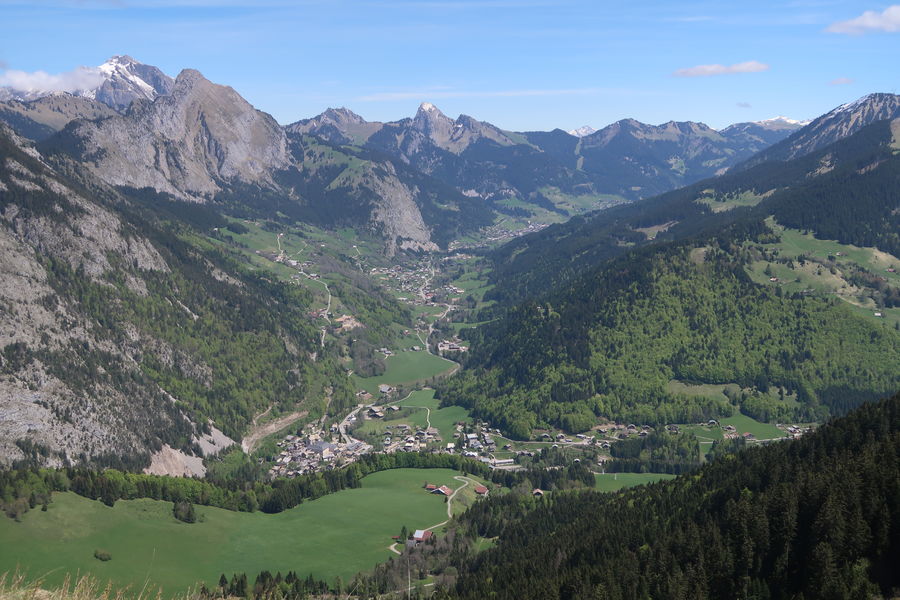
A tour to discover the Abondance cheese and la tomme. From the Ponite des Folly, the landscape of the Valléey of Abondance is very nice!
The characteristics of the route.

Abondance (74)
- Distance 15.2 km
- Elevation gain 830 m
- Elevation lost 830 m
- Min. elevation 922 m
- Max. elevation. 1671 m
- Duration (depending on pace) 4h20
- Marking Yes
This sportive hike starts in the centre of the village of Abondance. You will take the direction of the Essert cable car then you will discover the hamlet of Fremoux, its traditional houses and its mountain pastures.
You will be able to admire the whole valley of Abondance from the top of Fremoux.
You will then reach the Col de l'Ecuelle through a pretty forest of fir trees and along the alpine chalets.
At the top of the Follys, the highest point of this hike, you will be able to appreciate the landscape: the Mont de Grange, the Dents du Midi, the peaks of the Chablais and the lake of Geneva. Picnic tables invite you to enjoy the panoramic landscape.
You can also enjoy the view of the Mont de Grange and the village of Abondance as you descend to the chalets de l'Essert.
You will then head back to Fremoux Dessous to rejoin the path back to the village centre.Marking : Departmental markings called P.D.I.P.R. on beige metal panel with green letteringEquipments : Picnic area, Car park, Parking, Free car park, Admission fee : Free access.Opening : From 01/06 to 01/11. Accessible outside the snow season and subject to weather conditions. Please check with the Tourist Office beforehand for current access conditions. Recommended season: spring - summer - autumn.
Report a problem Add a comment
Website
Add your time and share your feelings
Contact 04 50 73 02 90 abondance@otpeva.com
Information updated on 2023-06-08 by Office de Tourisme intercommunal Pays d'Evian Vallée d'Abondance

OK
Annuler


