Route 13 - Tour du Puy Griou
Add to my favorites

Route opened

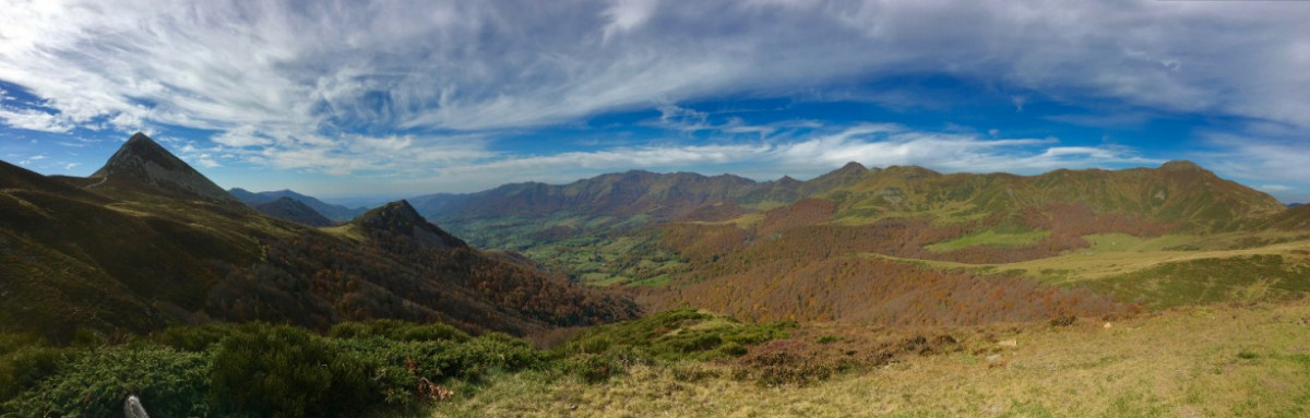
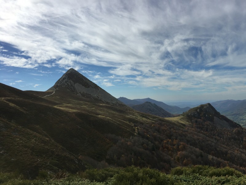
This itinerary without technical difficulties allows to realize a very complete course, offering very varied terrains. You will first run along pastures, before reaching a more wooded area, gradually climbing to the Col de Cabre. You will then enjoy 3km with exceptional views over the valley before finding a more wooded landscape at the end of the route, running down to Mandailles Saint Julien.
The characteristics of the route.
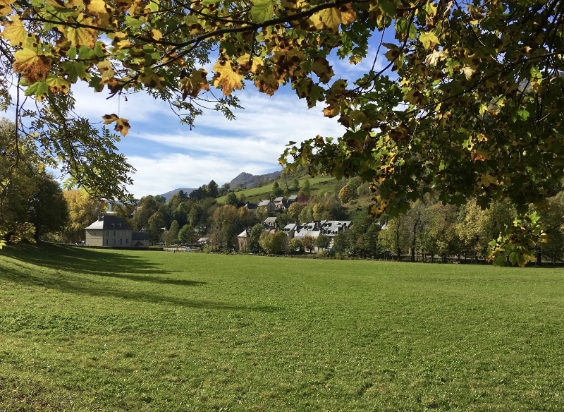
Mandailles-Saint-Julien (15)
- Distance 17.7 km
- Elevation gain 763 m
- Elevation lost 762 m
- Min. elevation 922 m
- Max. elevation. 1564 m
- Duration (depending on pace) 2h30 à 4h10
- Marking 13 blue
The latest reviews & times
pcombet
finished in 03:20:00
The 2025/08/17
En savoir plus
Terrydkz
finished in 02:01:01
The 2023/08/09
En savoir plus
Lili34
The 2023/06/25
En savoir plus
Ly1ju
finished in 02:21:00
The 2022/08/22
En savoir plus
Ly1ju
The 2022/08/22
En savoir plus
See all reviews & times
2025/08/17 03:20:00
pcombet
pcombet
Superbe parcours ! merci. Des sous-bois, de belles petites côtes, une crête, des cols, nombreuses portions roulantes, et un petit sommet bien technique si on monte sur le Puy Griou. À la descente, les sous-bois arrivent assez vite. C’est parfait quand il fait chaud comme aujourd’hui.
2023/08/09 02:01:01
Terrydkz
Terrydkz
2023/06/25 Lili34
Superbe parcours, varié avec de belles traces. Nous sommes monté au puy griou avant de redescendre.
2022/08/22 02:21:00
Ly1ju
Ly1ju
Super parcours !
2022/08/22 Ly1ju
Un très très beau parcours de Trail je recommande vivement !
2021/11/07 02:53:00
SteFa
SteFa
A cette période de l année, partir le matin pour redescendre en début d après midi et éviter d être surpris par les changements climatiques en hauteur, surtout avec la neige.
2021/05/28 02:10:00
Fredery
Fredery
2021/05/01 Mi Ka
Manque toujours le petit carré 13 pour descendre sur liadouze au bout d'un km environ après le départ.
Sinon très beau parcours bien indiqué.
2018/08/02 Marie Robert
Superbe parcours !! Juste 1 problème de balisage : ne pas oublier de tourner à gauche pour descendre sur Liadouze après les 400m de chemin qui monte. Il manque le balisage à cet endroit la, seul le parcours 12 est indiqué.
Sinon, superbe superbe superbe. Merci
Services nearby

Gîte d'étape et de séjour Vert Azur
Mandailles-Saint-Julien

Camper-vans service areas and Campsites
Mandailles-Saint-Julien

Maison de Site of Mandailles-Saint-Julien
Mandailles-Saint-Julien

Guest house “THE FOUR SEASONS”
Mandailles-Saint-Julien

Aux Genêts d'Or
Mandailles-Saint-Julien


Follow us on
the digital trails
the digital trails


![]()
 Puy Mary Espace Trail - Parcours - Route 13 - Tour du Puy Griou
Hello, world! This is a toast message.
Puy Mary Espace Trail - Parcours - Route 13 - Tour du Puy Griou
Hello, world! This is a toast message.
Puy Mary Espace Trail - Parcours - Route 13 - Tour du Puy Griou
Hello, world! This is a toast message.


OK
Annuler