Randonnée des Cimes d'Auron
Add to my favorites

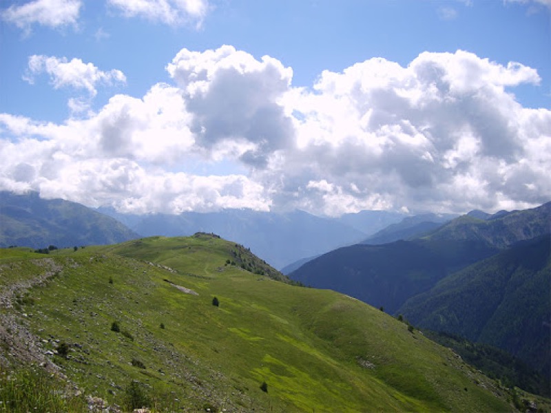
You will discover a climbe till the Blainon pass that will offer a panoramic view on the valley then a easy descent till the village
The characteristics of the route.
Auron (06)
- Distance 12.54 km
- Elevation gain 650 m
- Elevation lost 650 m
- Min. elevation 1547 m
- Max. elevation. 2107 m
Read before you go!
- Follow the marked trails, don't take shortcuts.
- Before setting out on a trail, check the weather, make sure it's suitable for your level, and leave your route with someone.
- Be careful.
- Be extra careful during hunting season and find out about current drives.
- If you encounter livestock protection dogs, remain calm, avoid sudden movements, and go around the herd.
- Respect private property and cultivated areas, and close gates after you've left.
- Behave in an eco-friendly way: take your waste with you and respect the flora and fauna to preserve nature.
- Always download the route (GPX) corresponding to the route in question.
Area : Auron
Report a problem
Eric83
The 2025/08/15
En savoir plus
Ajouter votre chrono et partager vos sensations
2025/08/15 Eric83
magnifique montée en sous bois et belvédère crête jusqu'au blainon puis descente désagréable sur les pistes. mieux vaut faire demi tour depuis le haut du blainon
2025/08/15 Eric83
magnifique montée en sous bois et belvédère crête jusqu'au blainon puis descente désagréable sur les pistes. mieux vaut faire demi tour depuis le haut du blainon
Services nearby

Crédit Agricole
Auron

ALZINA Cécile -Osteopath
Auron

Restaurant Crêperie La Taca d'oli
Auron

MONICA Immobilier
Auron

Intersport Place Centrale
Auron


Follow us on
the digital trails
the digital trails


![]()
Info & contacts
Offices de Tourisme du territoire
Auron : +33(0)4 93 23 02 66
St Etienne de Tinée : +33(0)4 93 02 41 96
St Dalmas le Selvage : +33(0)4 93 02 46 40
 Auron Outdoor - Parcours - Randonnée des Cimes d'Auron
Hello, world! This is a toast message.
Auron Outdoor - Parcours - Randonnée des Cimes d'Auron
Hello, world! This is a toast message.
Auron Outdoor - Parcours - Randonnée des Cimes d'Auron
Hello, world! This is a toast message.


OK
Annuler