
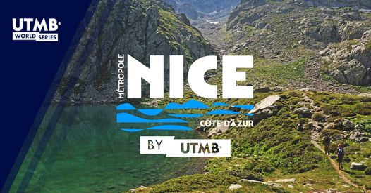
Mythical distance, the 100 miles will start from Auron and quickly reach the highest point of the route at more than 2,650 meters above sea level: the Rabuons and their unique mineral landscapes along the path of energy. After having crossed chestnut forests and the meanders of the Tinée on several occasions, you will have the chance to follow the wonders of the Mercantour massif then to evolve on beautiful ridges at the mid-point at more than 2000m altitude. Then, direction due south through more Mediterranean landscapes. A last effort to cross the 4 mountains: Mont Leuze, Mont Vinaigrier, Mont Alban and Mont Boron, and at the bend of a steep staircase, you will find yourself by the sea, a magical landscape so different from anything you have been able to admire. . The final along the coast will take you to the coveted finish on the Promenade des Anglais!
- Distance 163.3 km
- Elevation gain 9420 m
- Elevation lost 11000 m
- Min. elevation 0 m
- Max. elevation. 2710 m
- Duration (depending on pace) 25h à 50h


the digital trails


![]()
Info & contacts
Offices de Tourisme du territoire
Auron : +33(0)4 93 23 02 66
St Etienne de Tinée : +33(0)4 93 02 41 96
St Dalmas le Selvage : +33(0)4 93 02 46 40
 Auron Outdoor - Parcours - Auron-Nice by UTMB : from Mercantour to Côte d'Azur
Auron Outdoor - Parcours - Auron-Nice by UTMB : from Mercantour to Côte d'Azur
Auron Outdoor - Parcours - Auron-Nice by UTMB : from Mercantour to Côte d'Azur
Auron Outdoor - Parcours - Auron-Nice by UTMB : from Mercantour to Côte d'Azur
Auron Outdoor - Parcours - Auron-Nice by UTMB : from Mercantour to Côte d'Azur

