
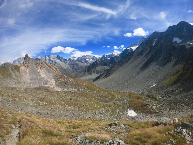
Starting from Euseigne, this route covering over 100km and 6,450m+ will allow you to discover the entire Hérens Valley. You will have the pleasure of admiring the many facets of this valley. Glaciers, lakes, waterfalls, rocks, altitude, etc... and get a taste of everything that can be found in the mountains.
- Distance 100.96 km
- Elevation gain 6450 m
- Elevation lost 6450 m
- Min. elevation 930 m
- Max. elevation. 2986 m
- Duration (depending on pace) 3 jours
- Marking Soon
From Euseigne, the route heads towards Hérémence. The trail then climbs to Mont Rouge via Thyon. A superb balcony trail takes you towards Lac des Dix, but before reaching it, you will cross the Col des Roux before reaching the lake shore and following it to its end. From there, the trail climbs towards Col de Riedmatten. There are superb views of the Cheilon glacier overlooked by Cabane des Dix. The descent after the pass is very steep at first, then levels out as you reach Arolla. The balcony trail connecting Evolène allows for a short break before heading towards Col des Bossons from Pas de Lona. The view is breathtaking! You will then take the Vallon de Réchy and the Pas de Lovégno to reach Saint Martin. You will then descend into the valley floor to cross ‘la Borgne’ and return to Euseigne.


the digital trails


![]()
Info & contacts
Saint Martin Tourisme
Rue de l’Église 7
1969 SAINT MARTIN (SUISSE)
+41 (0) 27 281 24 74
trail@valdherens.ch
 Alpes Trail Val d’Hérens - Parcours - Route 10 - Grand Tour of the Val d'Hérens
Alpes Trail Val d’Hérens - Parcours - Route 10 - Grand Tour of the Val d'Hérens
Alpes Trail Val d’Hérens - Parcours - Route 10 - Grand Tour of the Val d'Hérens
Alpes Trail Val d’Hérens - Parcours - Route 10 - Grand Tour of the Val d'Hérens
Alpes Trail Val d’Hérens - Parcours - Route 10 - Grand Tour of the Val d'Hérens

