Route 17 - La grimpée du lynx
Add to my favorites

Signposted route. Enjoy your run !
Route opened
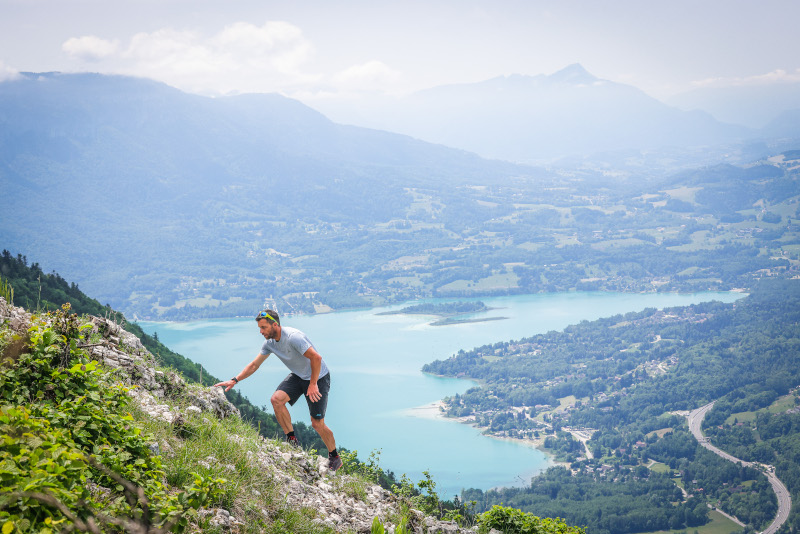
Starting from the village of Marcieux, this vertical will lead you to the Croix du Signal. After 300m of flat warm-up, you will start the climb, first through fields, then through the forest. Steep slopes will alternate with flatter sections, which will allow you to train your relaunch.
Note : the return can be done following the red routes 6 or 11.
The characteristics of the route.

Marcieux (73)
- Distance 7.79 km
- Elevation gain 920 m
- Elevation lost 30 m
- Min. elevation 558 m
- Max. elevation. 1453 m
- Duration (depending on pace) 1h20 à 2h50
- Marking Trail-running n°17 orange + hiking markers
Read before you go!
Caution: at km 8, there are ladders to climb. Possibility of an alternative route bypassing the route indicated as a variant
Report a problem
Website Pdf file - Route 17 gravanel
finished in 00:55:00
The 2024/01/16
En savoir plus
Ajouter votre chrono et partager vos sensations
2024/01/16 00:55:00
gravanel
gravanel
boue en bas, verglas au milieu, neige en haut
2024/01/16 00:55:00
gravanel
gravanel
boue en bas, verglas au milieu, neige en haut
Services nearby

Rental of mountain bikes
Nances
Via ferrata equipment rental
Nances
Pleasure boat rental (Vertes Sensations)
Nances
Electrically-powered mountain biking around Lac d'Aiguebelette
Nances
Water craft hire (Vertes Sensations)
Nances


 Espace outdoor du Lac d’Aiguebelette - Parcours - Route 17 - La grimpée du lynx
Hello, world! This is a toast message.
Espace outdoor du Lac d’Aiguebelette - Parcours - Route 17 - La grimpée du lynx
Hello, world! This is a toast message.
Espace outdoor du Lac d’Aiguebelette - Parcours - Route 17 - La grimpée du lynx
Hello, world! This is a toast message.


OK
Annuler