Trail
Add to my favorites

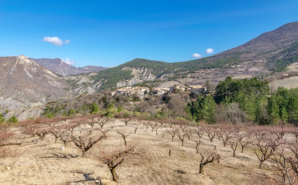
Escape to the heights of Montréal-les-Sources! A refreshing interlude among streams and cherry orchards.
The characteristics of the route.

Montréal-les-Sources (26)
- Distance 4.17 km
- Elevation gain 160 m
- Elevation lost 160 m
- Min. elevation 590 m
- Max. elevation. 721 m
- Duration (depending on pace) 1h15
- Marking No
Looking for a bucolic walk in the heart of nature, I was well served. This itinerary in the hills allowed me to discover the authenticity of Montréal-les-Sources. The backdrop of the Eygues valley is remarkable. The cherry orchards and cool springs make for a pleasant walk in any season. It's a wise choice to immerse yourself in the agricultural landscape of the Baronnies provençales."
Hugo COLIN, intern at the Pnr des Baronnies provençales
From the parking lot at Montréal-les-Sources, follow the departmental road towards the village.
1- Take the "Chemin du Col d'Ambon" on the right.
2- After 700m, fork left on the track around the farmhouse towards the Saint-Julien chapel. Once there, turn around to return to the road. Keep to the left, leaving the route up to the pass on the right. Continue for 500m to the next junction.
3- Go back down to Vignasse on the left.
4- Once past the hamlet, take the first left to return to Montréal-les-Sources. After passing Ruisseau Saint-Julien, head up towards the village.
5- Take the first left-hand lane through the village. At the fountain under the porch, follow the calade to the right, which takes you to the church. Go around the square to return to the village exit. Follow the road to the right to reach the parking lot.Admission fee : Free access.Opening : All year round.
Hugo COLIN, intern at the Pnr des Baronnies provençales
From the parking lot at Montréal-les-Sources, follow the departmental road towards the village.
1- Take the "Chemin du Col d'Ambon" on the right.
2- After 700m, fork left on the track around the farmhouse towards the Saint-Julien chapel. Once there, turn around to return to the road. Keep to the left, leaving the route up to the pass on the right. Continue for 500m to the next junction.
3- Go back down to Vignasse on the left.
4- Once past the hamlet, take the first left to return to Montréal-les-Sources. After passing Ruisseau Saint-Julien, head up towards the village.
5- Take the first left-hand lane through the village. At the fountain under the porch, follow the calade to the right, which takes you to the church. Go around the square to return to the village exit. Follow the road to the right to reach the parking lot.Admission fee : Free access.Opening : All year round.
Report a problem
Website Pdf file
Add your time and share your feelings
Services nearby

Canyon découverte du Val d'Oule
Rémuzat

Neaclub les Lavandes Drôme Provençale
Rémuzat
Lou Cafetoun Bar-Restaurant
Curnier
L'Adrien
Rémuzat

Tiny Baronnies
Cornillac


Information updated on 2024-07-18 by Office de Tourisme des Baronnies en Drôme Provençale


Follow us on
the digital trails
the digital trails



 Espace Trail of Baronnies in Drôme Provençale - Parcours - Trail
Hello, world! This is a toast message.
Espace Trail of Baronnies in Drôme Provençale - Parcours - Trail
Hello, world! This is a toast message.
Espace Trail of Baronnies in Drôme Provençale - Parcours - Trail
Hello, world! This is a toast message.


OK
Annuler