Les chemins d'antan
Add to my favorites

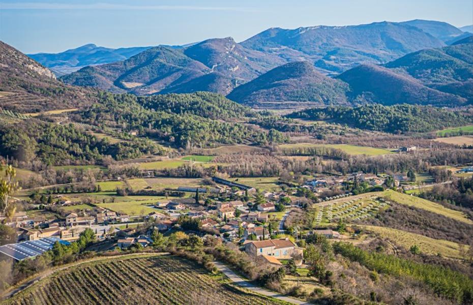
A walk steeped in history as you pass through the old village of Condorcet and the hamlet of Saint Pons, where the inhabitants were shot during the Second World War for acts of resistance.
The characteristics of the route.

Condorcet (26)
- Distance 10.71 km
- Elevation gain 350 m
- Elevation lost 350 m
- Min. elevation 342 m
- Max. elevation. 584 m
- Duration (depending on pace) 2h51
- Marking Yes
Parking near the church.
1. Leave behind the church, at the Condorcet Église sign (alt. 357 m). Climb a narrow path alongside the cemetery. Join the road rising towards the old village. (You can visit the ruins of the old village by going up on the right. An association is working to restore its streets).
2. Pass by the old village, and continue on the main track. At the end, take the left-hand path and, before reaching a ruin, take a path to the right (a short, difficult section). Then climb up into a sparse pine forest, which you cross in a north-westerly direction.
3. Then descend to the hamlet of Saint-Pons, rejoining the road you followed uphill. Magnificent view of the Cougoir mountain. Pass the Saint-Pons chapel. Climb the asphalt road, staying on the main track. Further on, you come to a farm, and the asphalt road ends.
4. Continue on this track (do not turn off towards Les Crozes). Just before you reach a house, turn left down a wide path which soon becomes a footpath again, heading for the stream. Cross the stream, continue straight ahead on a track and arrive behind a house. Pass to the left of the house and take the left-hand path. Follow this to the road back to Condorcet.Admission fee : Free access.Opening : All year round daily.
1. Leave behind the church, at the Condorcet Église sign (alt. 357 m). Climb a narrow path alongside the cemetery. Join the road rising towards the old village. (You can visit the ruins of the old village by going up on the right. An association is working to restore its streets).
2. Pass by the old village, and continue on the main track. At the end, take the left-hand path and, before reaching a ruin, take a path to the right (a short, difficult section). Then climb up into a sparse pine forest, which you cross in a north-westerly direction.
3. Then descend to the hamlet of Saint-Pons, rejoining the road you followed uphill. Magnificent view of the Cougoir mountain. Pass the Saint-Pons chapel. Climb the asphalt road, staying on the main track. Further on, you come to a farm, and the asphalt road ends.
4. Continue on this track (do not turn off towards Les Crozes). Just before you reach a house, turn left down a wide path which soon becomes a footpath again, heading for the stream. Cross the stream, continue straight ahead on a track and arrive behind a house. Pass to the left of the house and take the left-hand path. Follow this to the road back to Condorcet.Admission fee : Free access.Opening : All year round daily.
Report a problem
Add your time and share your feelings
Services nearby

Lou Cafetoun Bar-Restaurant
Curnier
La Scourtinerie
Nyons
Musée du Scourtin
Nyons

Philippe Meffre
Nyons

Séjour sur-mesure
Nyons


Information updated on 2026-07-05 by Conseil départemental de la Drôme


Follow us on
the digital trails
the digital trails



 Espace Trail of Baronnies in Drôme Provençale - Parcours - Les chemins d'antan
Hello, world! This is a toast message.
Espace Trail of Baronnies in Drôme Provençale - Parcours - Les chemins d'antan
Hello, world! This is a toast message.
Espace Trail of Baronnies in Drôme Provençale - Parcours - Les chemins d'antan
Hello, world! This is a toast message.


OK
Annuler