Marcel et Devès
Add to my favorites

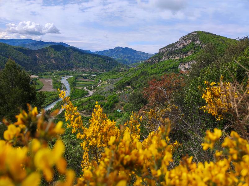
Here's the tour of Le Devès, with a southern section full of rocky outcrops and olive groves, followed by a northern section, called Marcel, full of shade and slopes. There's no shortage of views!
The characteristics of the route.
Sahune (26)
- Distance 5.82 km
- Elevation gain 310 m
- Elevation lost 310 m
- Min. elevation 360 m
- Max. elevation. 655 m
- Duration (depending on pace) 2h30
- Marking Yes
Parking behind the town hall, or on the public square on the banks of the Eygues, route de Montréal.
1 Go right from the Mairie de Sahune (alt. 360m), up to the parking lot. At the end, continue along the gravel path. Head north on a steadily uphill path through olive groves. After a 45-minute walk, leave the TV relay station on your left to reach a restored sheepfold and a pass (view over the Eygues valley).
2. At the La Bergerie post (alt. 630m), follow the signs for Le Marcel to the west (left-hand path in the woods).
3. You reach a second pass with a crossroads: Le Marcel (alt. 656m). From here, climb back and forth to the Devès summit. On the way back to the pass, follow the signs for Sahune on the left (no horses allowed) through the undergrowth. Enjoy the balcony overlooking the Romezelier gorges, before coming into view of the Eygues valley. The path then twists and turns downhill, leading to a field of olive trees, which you cross at the edge. Take a path that joins the départementale 94. Turn left and take this road to Sahune.Admission fee : Free access.Opening : All year round daily.
1 Go right from the Mairie de Sahune (alt. 360m), up to the parking lot. At the end, continue along the gravel path. Head north on a steadily uphill path through olive groves. After a 45-minute walk, leave the TV relay station on your left to reach a restored sheepfold and a pass (view over the Eygues valley).
2. At the La Bergerie post (alt. 630m), follow the signs for Le Marcel to the west (left-hand path in the woods).
3. You reach a second pass with a crossroads: Le Marcel (alt. 656m). From here, climb back and forth to the Devès summit. On the way back to the pass, follow the signs for Sahune on the left (no horses allowed) through the undergrowth. Enjoy the balcony overlooking the Romezelier gorges, before coming into view of the Eygues valley. The path then twists and turns downhill, leading to a field of olive trees, which you cross at the edge. Take a path that joins the départementale 94. Turn left and take this road to Sahune.Admission fee : Free access.Opening : All year round daily.
Report a problem
Website Pdf file
Add your time and share your feelings
Services nearby
Lou Cafetoun Bar-Restaurant
Curnier

Canyon découverte du Val d'Oule
Rémuzat
Neaclub les Lavandes Drôme Provençale
Rémuzat
L'Adrien
Rémuzat
La Scourtinerie
Nyons


Information updated on 2026-07-05 by Conseil départemental de la Drôme


Follow us on
the digital trails
the digital trails



 Espace Trail of Baronnies in Drôme Provençale - Parcours - Marcel et Devès
Hello, world! This is a toast message.
Espace Trail of Baronnies in Drôme Provençale - Parcours - Marcel et Devès
Hello, world! This is a toast message.
Espace Trail of Baronnies in Drôme Provençale - Parcours - Marcel et Devès
Hello, world! This is a toast message.


OK
Annuler