Le Col de Fabre
Add to my favorites

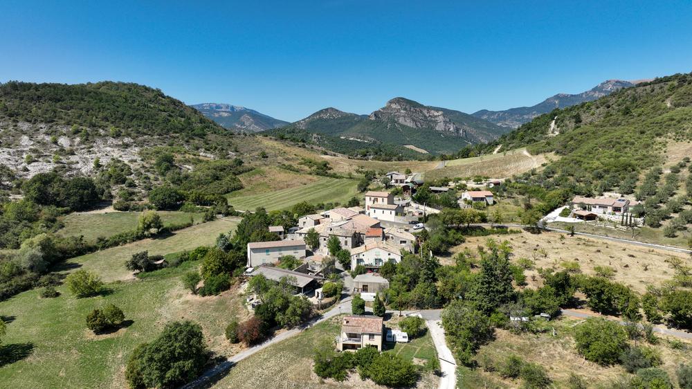
The tour takes in the surroundings of St-Ferréol-Trente-Pas and Eyroles. Take a break along a small stream. Once you've reached the Col de Fabre, the highest peak in the area, Montagne d'Angèle, at 1,606m, looms up in front of you.
The characteristics of the route.
Saint-Ferréol-Trente-Pas (26)
- Distance 11.59 km
- Elevation gain 390 m
- Elevation lost 390 m
- Min. elevation 411 m
- Max. elevation. 591 m
- Duration (depending on pace) 1h09
- Marking Yes
Beware of slippery, rocky descent.
Point 1: Village square
Point 2: Cemetery
right, follow Eyroles
Point 3: Eyroles
Go down into the village on the right, then take the first right
Point 4: Route fork
Leave the main track to the left on the downhill path, fork right at the next intersection. On the asphalt road, turn right.
Continue for 150 m on the D567 and take the right-hand track. At the next intersection, turn left.
Point 5: La camade
Take a slight left onto RD 567 and fork right.
Point 6: Ruisseau
After crossing the ford, leave the rising path on the left, staying alongside the stream.
Point 7: Road
Turn left up to the "Route de Sahune" crossroads.
Point 8: Route de Sahune
turn right and drive 2km
Point 9: Le Rotas
Turn left
10: Col de Fabre
Take the downhill track on the left
Point 11: Le monestier
Go straight on between the houses, turn right at the first intersection, then left at the second.Delicate passages : Watch out for the rocky and slippery slope.Admission fee : Free access.Opening : All year round daily.
Point 1: Village square
Point 2: Cemetery
right, follow Eyroles
Point 3: Eyroles
Go down into the village on the right, then take the first right
Point 4: Route fork
Leave the main track to the left on the downhill path, fork right at the next intersection. On the asphalt road, turn right.
Continue for 150 m on the D567 and take the right-hand track. At the next intersection, turn left.
Point 5: La camade
Take a slight left onto RD 567 and fork right.
Point 6: Ruisseau
After crossing the ford, leave the rising path on the left, staying alongside the stream.
Point 7: Road
Turn left up to the "Route de Sahune" crossroads.
Point 8: Route de Sahune
turn right and drive 2km
Point 9: Le Rotas
Turn left
10: Col de Fabre
Take the downhill track on the left
Point 11: Le monestier
Go straight on between the houses, turn right at the first intersection, then left at the second.Delicate passages : Watch out for the rocky and slippery slope.Admission fee : Free access.Opening : All year round daily.
Report a problem
Add your time and share your feelings
Services nearby
Lou Cafetoun Bar-Restaurant
Curnier
La Scourtinerie
Nyons
Musée du Scourtin
Nyons

Philippe Meffre
Nyons

Séjour sur-mesure
Nyons


Information updated on 2026-07-09 by Conseil départemental de la Drôme


Follow us on
the digital trails
the digital trails



 Espace Trail of Baronnies in Drôme Provençale - Parcours - Le Col de Fabre
Hello, world! This is a toast message.
Espace Trail of Baronnies in Drôme Provençale - Parcours - Le Col de Fabre
Hello, world! This is a toast message.
Espace Trail of Baronnies in Drôme Provençale - Parcours - Le Col de Fabre
Hello, world! This is a toast message.


OK
Annuler