La Bouscaude
Add to my favorites

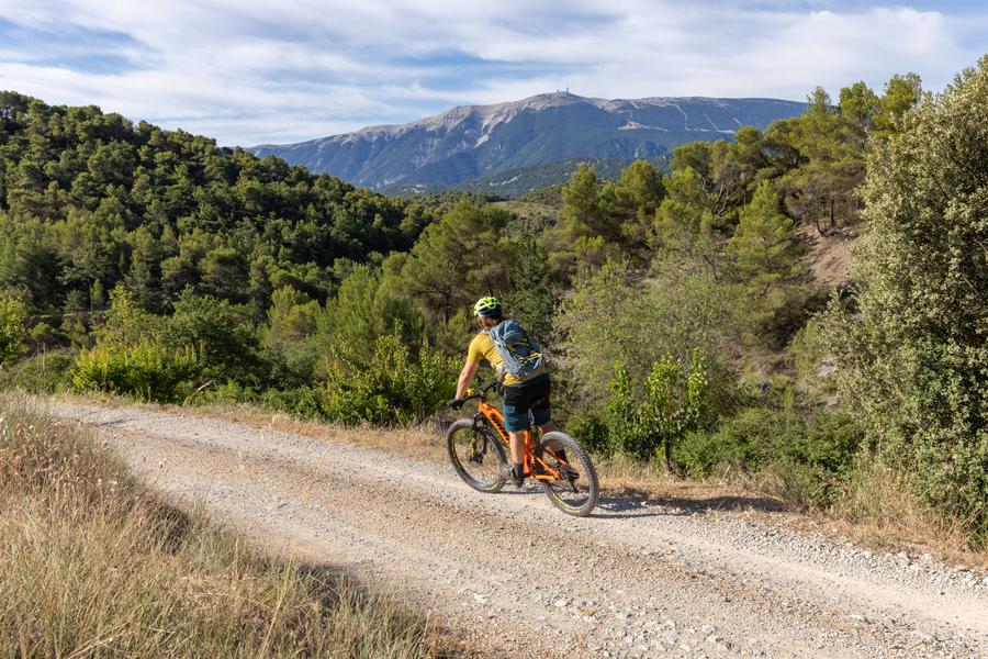
This fairly complete route, with its beautiful panoramas and forest passages, will delight both beginners and more experienced mountain bikers, with some technical sections.
The characteristics of the route.

Buis-les-Baronnies (26)
- Distance 14.65 km
- Elevation gain 360 m
- Elevation lost 360 m
- Min. elevation 340 m
- Max. elevation. 640 m
- Duration (depending on pace) 2h
- Marking Yes
Point 1: Place du Quinconce (km 0 - 371m)
Cross the Ouvèze bridge, turn left, then take the first right towards Saint-Julien.
Continue straight ahead through the 4/5 bends. (km 0.7 - 400m)
Point 2: Chapelle St-Trophime (km 2.4 - 500m)
Pass the chapel and continue on the asphalt road.
Point 3: Ferme de la Nible (km 5, 570m)
Go straight on, then turn right at the descent.
Point 4: Champollon (km 7 - 643m)
At the top of the pass, turn right down the stony track.
Point 5: Intersection (km 8.7 - 550m)
Continue straight on. CAUTION technical descent.
Point 6: Petit Ubac (km 9.4 - 489m)
Descend the track to the right and continue straight on until you reach a tarmac road.
Point 7: Road (km 11.5 - 337m)
Turn right and continue to Buis-les-Baronnies.
Point 8: Place du Quinconce (km 14.87 - 371m)Admission fee : Free access.Opening : All year round daily.
Cross the Ouvèze bridge, turn left, then take the first right towards Saint-Julien.
Continue straight ahead through the 4/5 bends. (km 0.7 - 400m)
Point 2: Chapelle St-Trophime (km 2.4 - 500m)
Pass the chapel and continue on the asphalt road.
Point 3: Ferme de la Nible (km 5, 570m)
Go straight on, then turn right at the descent.
Point 4: Champollon (km 7 - 643m)
At the top of the pass, turn right down the stony track.
Point 5: Intersection (km 8.7 - 550m)
Continue straight on. CAUTION technical descent.
Point 6: Petit Ubac (km 9.4 - 489m)
Descend the track to the right and continue straight on until you reach a tarmac road.
Point 7: Road (km 11.5 - 337m)
Turn right and continue to Buis-les-Baronnies.
Point 8: Place du Quinconce (km 14.87 - 371m)Admission fee : Free access.Opening : All year round daily.
Report a problem
Add your time and share your feelings
Services nearby

Au Temps du Vivant
Buis-les-Baronnies
Bureau des guides des Baronnies
Buis-les-Baronnies

Baronnies Sensations
Buis-les-Baronnies
Hôtel Les Arcades - Le Lion d'Or
Buis-les-Baronnies
Trail en Baronnies
Buis-les-Baronnies


Information updated on 2026-07-09 by Conseil départemental de la Drôme


Follow us on
the digital trails
the digital trails



 Espace Trail of Baronnies in Drôme Provençale - Parcours - La Bouscaude
Hello, world! This is a toast message.
Espace Trail of Baronnies in Drôme Provençale - Parcours - La Bouscaude
Hello, world! This is a toast message.
Espace Trail of Baronnies in Drôme Provençale - Parcours - La Bouscaude
Hello, world! This is a toast message.


OK
Annuler