Sur les hauteurs de l'Alagnon
Add to my favorites

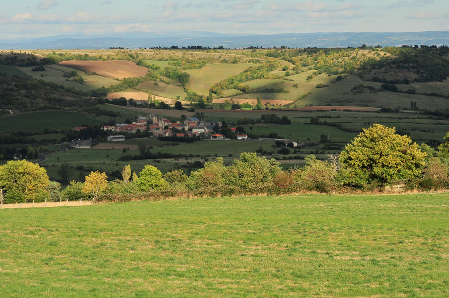
We plunge into the valleys of the Auze which offer pretty views of the Allagnon gorges, the lime of Caure (terraces) and the impressive fortress of Léotoing and a castle chapel and the castle of Torbiac.
The characteristics of the route.
Apchat (63)
- Distance 12.9 km
- Elevation gain 500 m
- Elevation lost 500 m
- Min. elevation 477 m
- Max. elevation. 682 m
- Duration (depending on pace) 3h45
- Marking Yes
Starting point - From the starting point, follow the road to Féchal-haut, and continue straight ahead (view of Léotoing castle, Livradois mountains, Margeride, Cézallier). After the farm of Marmaissat, go down the first path on the right which joins the stream of Auze. Go along it for about 1.5 km to an intersection.
1 - Turn right at an acute angle, cross the stream and climb the hill. On the flat, follow to the right, and at the next fork, turn to the left (view on the Allagnon valley). Continue on the road and, at the intersection, turn left, until you reach the entrance of the village of Brugeilles. Turn right for a long climb up the hillside of the Bave valley. At the intersection, continue straight ahead, pass under the high voltage line and walk to a fork.
2 - Go up the path to the right (view of the village of Bousselargues). At the crossroads on the plateau, go opposite in the valley (view on the Auze valley). Leave a path on the right, continue until you reach a footbridge on the Auze, and climb up by a wide path that leads back to the beginning.
visitor alert: Footbridge out of order, hiking possible in dry weather only. Upcoming restoration.Marking : YellowAdmission fee : Free access.Opening : From 01/01 to 31/12. Subject to favorable weather.
Report a problem
Website
Add your time and share your feelings


Information updated on 2024-06-12 by Conseil départemental du Puy-de-Dôme


Agglo Pays d'Issoire
Service Sport
04 15 62 20 00
![]()
Communauté de Communes du Massif du Sancy
Pôle de Pleine Nature
04 73 65 24 48
 Espace Trail Cœur d'Auvergne - Parcours - Sur les hauteurs de l'Alagnon
Hello, world! This is a toast message.
Espace Trail Cœur d'Auvergne - Parcours - Sur les hauteurs de l'Alagnon
Hello, world! This is a toast message.
Espace Trail Cœur d'Auvergne - Parcours - Sur les hauteurs de l'Alagnon
Hello, world! This is a toast message.


OK
Annuler