
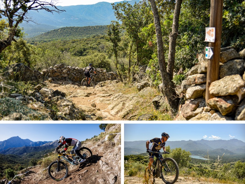
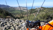
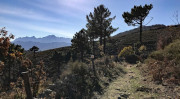
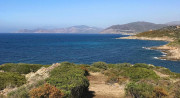
Our mountain bike area, approved by the French Cycling Federation, offers 15 incredible loops throughout the Balagne region, offering a variety of landscapes and challenges for all levels. From the rocky tracks of the seaside to the mountain trails of the Ghjunsani, our mountain biking area has something for everyone! It's perfect for families and the most experienced mountain bikers alike. Ride through the enchanting valleys of the Ghjunsani, explore the picturesque villages of the hinterland, and feel the adrenaline rush on the more technical loops – it’s an unforgettable experience!
For the past two years, Lisula has been the proud host of the Coupe de France Enduro Series Final at the Corsica Bike Festival, the only cycling and mountain bike festival in Corsica. Get ready to experience the same intensity as the professional riders as you discover the trails they had to tackle!
No matter if you're a beginner or an expert, our destination offers a variety of routes steeped in Corsican authenticity, perfect for you! It's time to strap on your helmet, adjust your equipment and get ready for an unforgettable mountain biking experience in the beautiful Lisula! Here, the mountain biking adventure really comes into its own.
5.62km 60m 60m
Speloncato
Route opened

18.71km 450m 450m
Speloncato
Route opened
22.16km 560m 560m
Belgodère
Route opened
20.08km 540m 540m
L'Île-Rousse
Warning

6.23km 70m 70m
Algajola
Route opened

25.4km 740m 740m
Algajola
Route opened

20.88km 500m 500m
Calvi
Route opened

5.17km 150m 150m
Calvi
Route opened

12.2km 330m 330m
Olmi-Cappella
Route opened
25.57km 960m 960m
Olmi-Cappella
Warning

13.83km 290m 290m
Calvi
Route opened
25.15km 700m 700m
L'Île-Rousse
Route opened

6.48km 60m 60m
Belgodère
Route opened

7.04km 100m 100m
Montegrosso
Route closed

12km 200m 200m
Montegrosso
Route closed

To help you find your way around the terrain, the routes in the MTB-FFC Balagna Area are equipped with directional mountain bike markers. Each beacon is marked with the number(s) of the route to follow and the colour of the difficulty : green - blue - red - black.
The mountain bike markers are placed at regular intervals, at each change of direction.
Safety and fun : our priority
Plan your next outdoor trip carefully.
Safety first : I share my itinerary and planned times with someone close to me for shared peace of mind. I use our mobile app to check the condition of the route before I set off
Check your equipment : make sure it's in good condition and suitable for the activity you're undertaking. Helmet required for cycling and mountain biking
Weather conditions : I check the weather forecast to prepare and make the most of my trip. Routes can be dangerous in bad weather Hydratation is essential : jI need to carry enough water. Some of the stages in the villages allow you to stop at a bar or café for refreshment, but most of the fountains in the hinterland do not have drinking water and there are no water points in the Agriate region. You should also take some food with you.
All sections of the route on public roads are subject to the Highway Code. Make sure you obey them.
On the paths: enjoy while preserving
Gates and fences: I make sure I close the gates on the paths to respect private land and pastures.Respect for nature: I respect the environment by not leaving rubbish on the paths. I will sort it out on my way home. I stay on the paths and respect the natural and agricultural environment I pass through.
Pets: If I walk with a dog, I make sure it doesn't go near the herds. I may even keep it on a lead to avoid any incidents.
CHunting: During the hunting season, especially when wild boar are hunted from mid-August to May, I have to be vigilant. If a hunt is in progress, I take the time to talk to the hunters to ensure everyone's safety.
Approaching animals: I walk around herds or let them pass. If I see wild animals, I admire them from a distance to preserve their natural habitat.
Protected areas: preserving natural treasures
Vallée du Reginu (Natura 2000 site): I admire the biodiversity while respecting the restrictions to preserve this unique but fragile ecosystem, where the red kite has flourished for many years.
The Agriate (Conservatoire du Littoral): protected by the Conservatoire du Littoral, the Agriate is a natural jewel. I follow the recommended itineraries and do not bivouac or light fires.
Losari (Conservatoire du Littoral): I explore the uncontaminated beauty of Losari, following the recommended itineraries and avoiding any disturbance to the flora and fauna.
Ostriconi: I contribute to the preservation of this fragile ecosystem by avoiding any behaviour likely to disturb the flora and fauna.

In the event of problem (lack of markings, maintenance problems, environmental problems...), do not hesitate to signal this problem by using the reporting tool available on the route page, on the website (button under the map) or in the mobile app. You will be able to geolocate the problem and also send a corresponding photo. The Espace manager will be automatically notified of your report and will be able to check and deal with the problem.

the digital trails


![]()
Infos & contacts
Tourism Office
Île Rousse - Lisula
+33(0)4 95 60 04 35
 Lisula - Outdoor & Trail - MTB-FFC

