
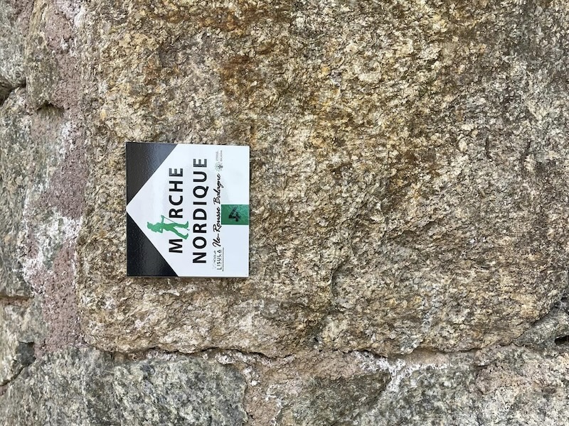
We are thrilled to announce the opening of our Nordic walking trails across the stunning landscape of Lisula. Whether you're a seasoned enthusiast or a curious novice, our destination offers a unique experience for all who are passionate about this activity.
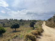
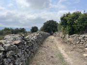
Nordic walking, a true symphony between the body and nature, allows you to fully immerse yourself in Lisula's majestic scenery. Whether it's for the joy of physical exertion, the exploration of new horizons, or simply to breathe in the fresh air, our trails invite you to experience unforgettable moments. Join us for an unparalleled sporting adventure, where every step brings you closer to the essence of well-being.
Prepare to discover Nordic walking like never before. Let yourself be captivated by the call of nature, by the magic of Lisula's landscapes, and by the spirit of achievement that inspires us all.
Let the adventure begin!

5.44km 60m 60m
Speloncato
Route opened

6.47km 60m 60m
Belgodère
Route opened

8.62km 90m 310m
Monticello
Route opened

7.56km 200m 200m
Urtaca
Route opened

7.94km 260m 260m
Monticello
Warning
9.63km 340m 340m
Corbara
Route opened

10.7km 250m 250m
L'Île-Rousse
Warning

11.88km 170m 380m
Santa-Reparata-di-Balagna
Route opened

8.46km 337m 337m
Pioggiola
Route opened

14.84km 420m 420m
Ville-di-Paraso
Route opened
21.86km 400m 520m
Belgodère
Route opened
Safety and fun : our priority
Plan your next outdoor trip carefully.
Safety first : I share my itinerary and planned times with someone close to me for shared peace of mind. I use our mobile app to check the condition of the route before I set off
Check your equipment : make sure it's in good condition and suitable for the activity you're undertaking.
Weather conditions : I check the weather forecast to prepare and make the most of my trip. Routes can be dangerous in bad weather Hydratation is essential : jI need to carry enough water. Some of the stages in the villages allow you to stop at a bar or café for refreshment, but most of the fountains in the hinterland do not have drinking water and there are no water points in the Agriate region. You should also take some food with you.
All sections of the route on public roads are subject to the Highway Code. Make sure you obey them.
On the paths: enjoy while preserving
Gates and fences: I make sure I close the gates on the paths to respect private land and pastures.Respect for nature: I respect the environment by not leaving rubbish on the paths. I will sort it out on my way home. I stay on the paths and respect the natural and agricultural environment I pass through.
Pets: If I walk with a dog, I make sure it doesn't go near the herds. I may even keep it on a lead to avoid any incidents.
CHunting: During the hunting season, especially when wild boar are hunted from mid-August to May, I have to be vigilant. If a hunt is in progress, I take the time to talk to the hunters to ensure everyone's safety.
Approaching animals: I walk around herds or let them pass. If I see wild animals, I admire them from a distance to preserve their natural habitat.
Protected areas: preserving natural treasures
Vallée du Reginu (Natura 2000 site): I admire the biodiversity while respecting the restrictions to preserve this unique but fragile ecosystem, where the red kite has flourished for many years.
The Agriate (Conservatoire du Littoral): protected by the Conservatoire du Littoral, the Agriate is a natural jewel. I follow the recommended itineraries and do not bivouac or light fires.
Losari (Conservatoire du Littoral): I explore the uncontaminated beauty of Losari, following the recommended itineraries and avoiding any disturbance to the flora and fauna.
Ostriconi: I contribute to the preservation of this fragile ecosystem by avoiding any behaviour likely to disturb the flora and fauna.

In the event of problem (lack of markings, maintenance problems, environmental problems...), do not hesitate to signal this problem by using the reporting tool available on the route page, on the website (button under the map) or in the mobile app. You will be able to geolocate the problem and also send a corresponding photo. The Espace manager will be automatically notified of your report and will be able to check and deal with the problem.

the digital trails


![]()
Infos & contacts
Tourism Office
Île Rousse - Lisula
+33(0)4 95 60 04 35
 Lisula - Outdoor & Trail - Nordic walking

