
A runnable trail that goes down to Cubières from the Station and back up to the Col de Finiels pass.

- Distance 16.9 km
- Elevation gain 690 m
- Elevation lost 690 m
- Min. elevation 970 m
- Max. elevation. 1636 m
- Duration (depending on pace) 2h15
- Suivre le balisage Yes

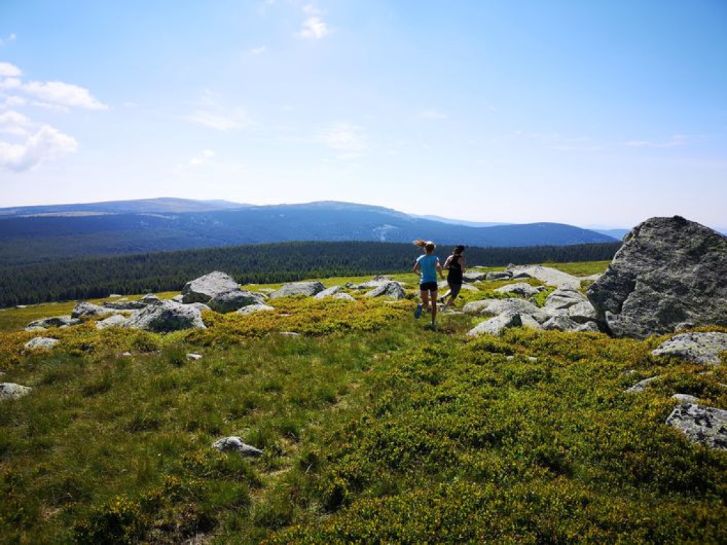
After the first kilometre, which is identical to trail #15, this trail forks east onto the path that goes downhill to Lozeret. From there, a pleasant path between forest and pasture takes you the rest of the way down to Cubières. You then start to climb through the forest, on a path for the first 3 kilometres and then on a track for the next 5. These 8 km of continuous uphill with 650 m of elevation gain take you to the Col de Finiels pass. The magnificent views are ample reward for your efforts. You climb a few more metres towards the summit so as to enjoy the panoramic views, then fork onto the GR®70, which leads back to the Station.
Follow the waymarks for trail #16.
Signposts will guide you all along this route, as well as yellow painted waymarks. In the description below, the signposted place names and/or directions are given in bold italics between quotation marks:
From the "Station du mont-Lozère", go down to "Cubières" via :
- "La Massola",
- "Le Bois de Neyrac",
- "Lozeret",
- "Le Réservoir".
- At “Cubières” go down to
- “Village”, then go up to “Col de Finiels” via :
- “Pelloufet”,
- “Bois du Mathieu”,
- “Louzero de Broussoux”,
- “Ancienne Voie Romaine”.
- At the “Col de Finiels” return to the “Station du mont-Lozère” via :
- “Col de Finiels”,
- “Sous le Col de Finiels”,
- “Col de la Draille” (2),
- “Parking des Chômeurs”,
- “La Chapelle du Mont Lozère”.
This trail is taken from the guidebook Mont Lozère – Pays des sources, published by the Pôle de pleine nature du mont Lozère.
Parking : Station du Mont-Lozère
Sommet souvent venté, pensez au coupe-vent. A éviter par fort brouillard ou fort vent. Vigilance particulière par temps de neige et/ou brouillard.
Attention sur Finiel, présence possible de chien(s) de protection (patou-s) sur le secteur, adaptez votre comportement.
Si vous débutez l'itinéraire de la station, toute la première partie est de la descente, assuré d'être assez en forme pour pouvoir remonter.
Avant de vous engager sur un circuit, vérifiez qu'il est adapté à votre activité et à votre niveau. N'oubliez pas que le temps change vite en montagne. Refermez bien les clôtures et les portillons. Restez sur les chemins balisés.
Get all the routes on your smartphone with the Lozère outdoor app. You'll find all outdoor activities (summer and winter seasons) and a host of functions :
- Take advantage of detailed IGN maps
- Download data for consultation even when you're not connected to the network
- Geolocate yourself at any time on the route and altimeter profile
- Activate the off-track alarm to be alerted if you stray from the itinerary
- Share your experience (add a report, share your lap time)...


the digital trails


![]()
The Lozère Outdoor application was created
by the Lozère Department
Infos & contacts
Conseil départemental de la Lozère
sportsnature@lozere.fr
+33(0)4 66 49 66 32
Crédits photos
 Lozère Outdoor - Parcours - Village on Mont Lozère’s northern slope, Trail #16
Lozère Outdoor - Parcours - Village on Mont Lozère’s northern slope, Trail #16
Lozère Outdoor - Parcours - Village on Mont Lozère’s northern slope, Trail #16
Lozère Outdoor - Parcours - Village on Mont Lozère’s northern slope, Trail #16
Lozère Outdoor - Parcours - Village on Mont Lozère’s northern slope, Trail #16

