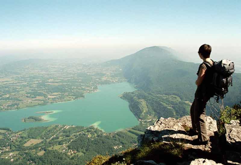
Mont Grêle summit
Add to my favorites


Physically challenging walk starting out from Attignat-Onicn, Lépin or Aiguebelette, with a change in altitude of 800 m and a clear view of the lake and its surrounding area (5 ½ to 6 ½ hrs, depending on the route).
The characteristics of the route.
Attignat-Oncin (73)
- Distance 12.9 km
- Elevation gain 860 m
- Elevation lost 860 m
- Min. elevation 599 m
- Max. elevation. 1426 m
- Duration (depending on pace) 5h30
- Marking Yes
Opening : All year round.
Report a problem
Website Fiche technique randonnée Le Mont-Grêle depuis Attignat-Oncin
Add your time and share your feelings
Services nearby

Vivre à vélo
Lépin-le-Lac
Fishing: permits, hire of small craft
Lépin-le-Lac
Boat rental at Aiguebelette-le-Lac Leisure base
Aiguebelette-le-Lac
Leisure base of the port: electric boat rentals
Aiguebelette-le-Lac
Plage du Sougey : locations nautiques
Saint-Alban-de-Montbel


Information updated on 2024-08-24 by Office de Tourisme Lac d'Aiguebelette


 Espace outdoor du Lac d’Aiguebelette - Parcours - Mont Grêle summit
Hello, world! This is a toast message.
Espace outdoor du Lac d’Aiguebelette - Parcours - Mont Grêle summit
Hello, world! This is a toast message.
Espace outdoor du Lac d’Aiguebelette - Parcours - Mont Grêle summit
Hello, world! This is a toast message.


OK
Annuler