Tour des Charbonnières: A10 Hiking Path
Add to my favorites

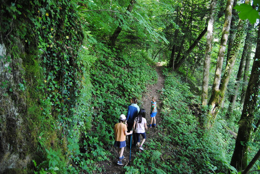
On a route of 5 km, you will be surprised by the diversity of natural habitats that you will cross: wet undergrowth, farming pastures and small hamlets...
The characteristics of the route.
Attignat-Oncin (73)
- Distance 5.33 km
- Elevation gain 240 m
- Elevation lost 240 m
- Min. elevation 430 m
- Max. elevation. 597 m
- Duration (depending on pace) 1h30
- Marking Yes
Marking : From the parking lot, cross the road at the bridge and follow directions for Bagné (yellow signage). After 200m along a small road, the trail runs alongside a prairie before leading into the Grenand Canyon forest.Delicate passages : Caution! Short craggy pathway with a metallic footbridge and handrails. Very slippery sections in rainy days.Opening : All year round daily.
Report a problem
Website Pdf file LDEZ
The 2025/07/08
En savoir plus
Ajouter votre chrono et partager vos sensations
2025/07/08 LDEZ
variété des paysages, par moments chemin étroit et encombré.
2025/07/08 LDEZ
variété des paysages, par moments chemin étroit et encombré.
Services nearby

Fishing: permits, hire of small craft
Lépin-le-Lac
Vivre à vélo
Lépin-le-Lac
Plage du Sougey : locations nautiques
Saint-Alban-de-Montbel
Boat rental at Aiguebelette-le-Lac Leisure base
Aiguebelette-le-Lac
Leisure base of the port: electric boat rentals
Aiguebelette-le-Lac


Information updated on 2025-06-23 by Office de Tourisme Lac d'Aiguebelette


 Espace outdoor du Lac d’Aiguebelette - Parcours - Tour des Charbonnières: A10 Hiking Path
Hello, world! This is a toast message.
Espace outdoor du Lac d’Aiguebelette - Parcours - Tour des Charbonnières: A10 Hiking Path
Hello, world! This is a toast message.
Espace outdoor du Lac d’Aiguebelette - Parcours - Tour des Charbonnières: A10 Hiking Path
Hello, world! This is a toast message.


OK
Annuler