
In the heart of a natural territory, with its green forests, its meadows, the rivers Creuse and Gartempe, the starry city of Rocroy and the valley of the Semoy, discover the territory of Vallées et Plateau d'Ardenne which gathers some of the most beautiful jewels of the Ardennes. The application offers you trail, hiking and mountain bike routes to discover the Valleys and Plateau of Ardenne while practicing your favorite activity.
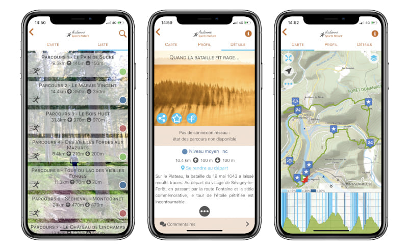
Once the application is installed, you will be able to download maps for offline use: Open Topo Map or IGN maps. The application also embeds all the routes as well as the associated altitude profiles.
Features of the application :
- location and orientation on detailed maps using your smartphone's GPS
- route description and points of interest on the route follow-up
- alert to be warned if you stray from the route
- participation in the DéfiTrail timed courses
- recording of your times
- send predefined messages by SMS to your contacts while running
- report a problem on the course
- add comments
- share on social networks
- 5 days weather forecast (source OpenWeatherMap)
- emergency module: trigger a call or send an emergency SMS in case of problem
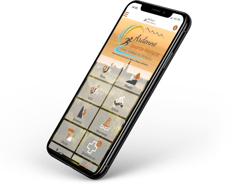
The advantages :
- hunting info section : access to the hunting calendar
- French / English version

the digital trails

![]()
Info & contacts
Communauté de Communes Vallées et Plateau d'Ardenne
6 rue de Montmorency - BP41
08230 Rocroi
ardennesportsnature@ccvpa.fr
Tel : 03 24 36 08 61
 Ardenne Espace Trail - The mobile application

