N°6 - Giru Belgudè - Pioggiola
Add to my favorites

Warning
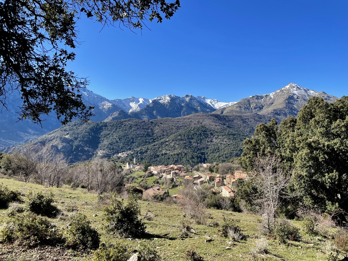
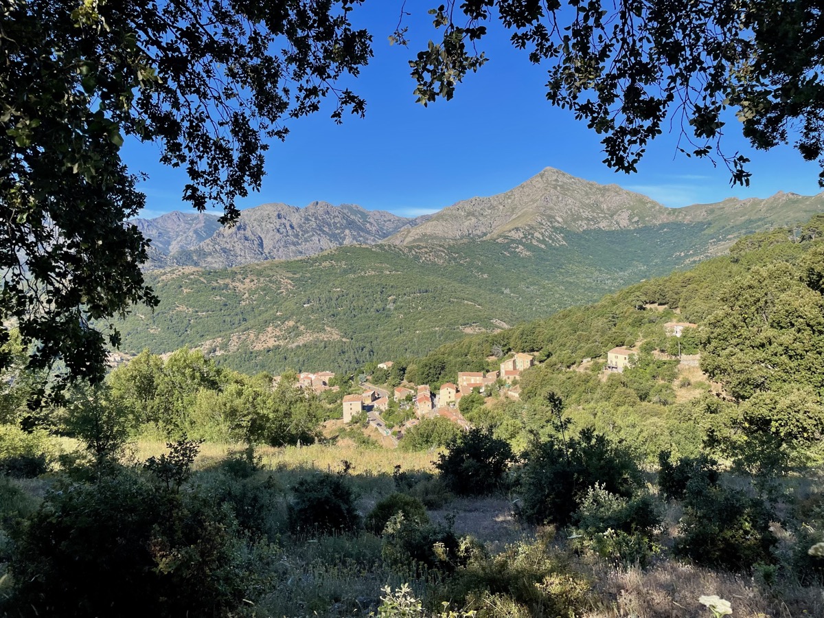
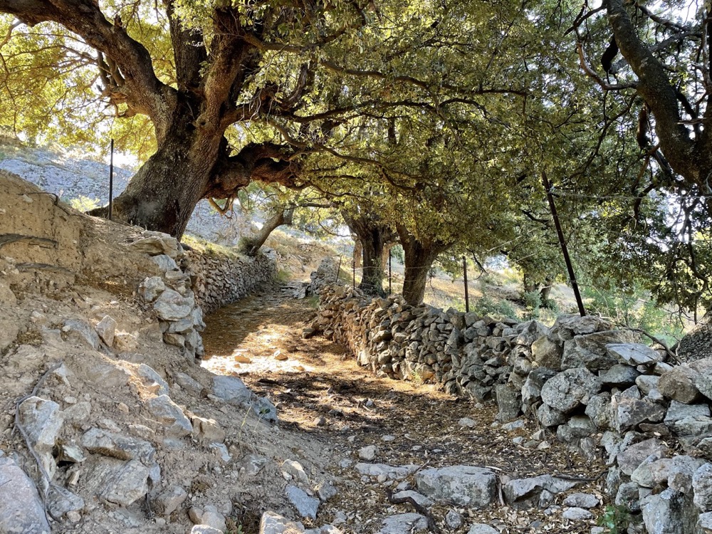
This route, accessible from the villages of Speloncato, Belgodere or Olmi-Cappella, takes you on a long outing between the hilltop villages and the foothills of the Ghjunsani.
The route alternates between footpaths, old mule tracks and wide ridge paths, offering exceptional panoramic views of both the mountains and the sea. A route without technical difficulties, but made demanding by its length.
The characteristics of the route.
Belgodère (2B)
- Distance 25.53 km
- Elevation gain 1340 m
- Elevation lost 1340 m
- Min. elevation 191 m
- Max. elevation. 1094 m
- Duration (depending on pace) 3h10 à 6h20
- Marking Trail-running n°6 red
Report a problem
PDF map The latest reviews & times
frlemp
The 2025/04/06
En savoir plus
0616961425
finished in 04:20:00
The 2024/07/24
En savoir plus
gweb
finished in 03:35:02
The 2023/08/05
En savoir plus
See all reviews & times
2025/04/06 frlemp
2024/07/24 04:20:00
0616961425
0616961425
superbe parcours malgré quelques ronces par moments
2023/08/05 03:35:02
gweb
gweb
2025/04/06 frlemp
2024/07/24 04:20:00
0616961425
0616961425
superbe parcours malgré quelques ronces par moments
2023/08/05 03:35:02
gweb
gweb
Services nearby

Église paroissiale San Tumasgiu
Belgodère
Belgodere
Belgodère

Café de la Paix - Café de France
Belgodère
Le Sans Souci
Belgodère
Epicerie A Buttega
Belgodère


Follow us on
the digital trails
the digital trails


![]()
Infos & contacts
Tourism Office
Île Rousse - Lisula
+33(0)4 95 60 04 35
 Lisula - Outdoor & Trail - Parcours - N°6 - Giru Belgudè - Pioggiola
Hello, world! This is a toast message.
Lisula - Outdoor & Trail - Parcours - N°6 - Giru Belgudè - Pioggiola
Hello, world! This is a toast message.
Lisula - Outdoor & Trail - Parcours - N°6 - Giru Belgudè - Pioggiola
Hello, world! This is a toast message.


OK
Annuler