
Discover trail routes

routes filtered
Only my favorites
Delete filters
Around me :
< 5km
< 10km
< 25km
< 50km
Inactive
Difficulties :
Easy
Medium
Difficult
Expert
Durée :
<1h
1-2h
2-3h
3-4h
>4h
Distance (km) :
<10
10-25
25-50
50-75
>75
Distance (km) :
<25
25-50
50-100
100-150
>150
Elevation gain (m) :
<500
500-1000
1000-1500
1500-2500
>2500
Elevation lost (m) :
<500
500-1000
1000-1500
1500-2500
>2500
Tags :
Areas :
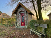
Route 1 - In the footsteps of Marguerite
9.22km 180m 180m
Saint-Jans-Cappel
Route opened
9.22km 180m 180m
Saint-Jans-Cappel
Route opened
Route 2 - The mountain range
31.97km 670m 670m
Saint-Jans-Cappel
Route opened
31.97km 670m 670m
Saint-Jans-Cappel
Route opened
Route 3 - From the mill to the Abbey
12.89km 320m 320m
Berthen
Route opened
12.89km 320m 320m
Berthen
Route opened
Route 4 - Destination La Trappe
22.61km 540m 540m
Boeschepe
Route opened
22.61km 540m 540m
Boeschepe
Route opened
Route 5 - Not without Fraud
5.42km 84m 84m
Godewaersvelde
Route opened
5.42km 84m 84m
Godewaersvelde
Route opened
Route 6 - From the mill to the Cosmos
6.21km 151m 151m
Rodeberg-Westouter
Route opened
6.21km 151m 151m
Rodeberg-Westouter
Route opened
Route 7 - The Round
11.7km 214m 214m
Rodeberg-Westouter
Route opened
11.7km 214m 214m
Rodeberg-Westouter
Route opened
Route 8 - Between the mountains
18.19km 350m 350m
Rodeberg-Westouter
Route opened
18.19km 350m 350m
Rodeberg-Westouter
Route opened
Route 9 - Among the vineyards
7.22km 181m 181m
Kemmel
Route opened
7.22km 181m 181m
Kemmel
Route opened

Circuit 10 - Tournée générale !
54.04km 1100m 1100m
Saint-Jans-Cappel
Route opened
54.04km 1100m 1100m
Saint-Jans-Cappel
Route opened

Circuit 11 - Trail du Reuze
7.95km 198m 198m
Cassel
Route opened
7.95km 198m 198m
Cassel
Route opened

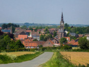
Circuit 12 - Cassel Up & Down
6.41km 230m 230m
Cassel
Route opened
6.41km 230m 230m
Cassel
Route opened

Circuit 13 - Cassel Urban Trail
12.44km 372m 372m
Cassel
Route opened
12.44km 372m 372m
Cassel
Route opened

Circuit 14 - TMC - Tour du Mont Cassel
21.49km 520m 520m
Cassel
Route opened
21.49km 520m 520m
Cassel
Route opened

Circuit 15 - L'ultra flamand
76.29km 1400m 1400m
Saint-Jans-Cappel
Route opened
76.29km 1400m 1400m
Saint-Jans-Cappel
Route opened

Circuit 16 - La Diagonale de Flandre
98.34km 1770m 1770m
Saint-Jans-Cappel
Route opened
98.34km 1770m 1770m
Saint-Jans-Cappel
Route opened

Liaison 1 - Godewaersvelde - Terdeghem
12.13km 90m 100m
Godewaersvelde
Route opened
12.13km 90m 100m
Godewaersvelde
Route opened

Liaison 2 - Terdeghem - Godewaersvelde
13.3km 110m 100m
Terdeghem
Route opened
13.3km 110m 100m
Terdeghem
Route opened


International
France
Belgium
 In Flanders Trails - Liste des activités

