La Draille de Saint-Sauveur
Add to my favorites

Route opened
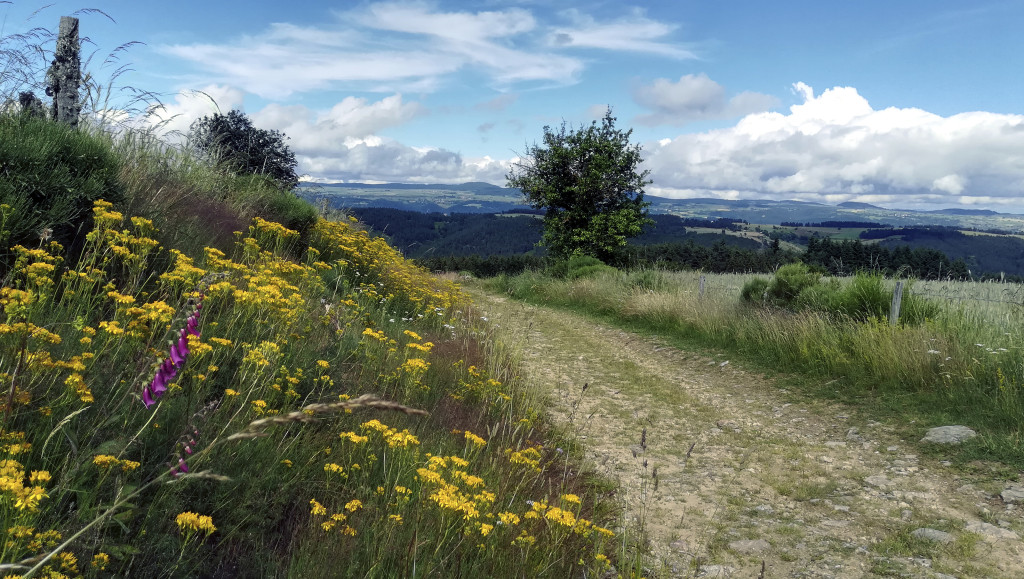
This circuit rises to offer very beautiful escapades on the surroundings, but also on the distant: the thing of Fortunio, the mount Lozère, the mount Gerbier de Jonc
A section of the tour is made on a path in the heath to callune and blueberries.
The characteristics of the route.

Saint-Sauveur-de-Ginestoux (19)
- Distance 9.22 km
- Elevation gain 210 m
- Elevation lost 210 m
- Min. elevation 1290 m
- Max. elevation. 1461 m
- Duration (depending on pace) 2h30
- Marking No
- Walk up a street facing the parking lot between an agricultural building and a house. At the level of another farm building, continue to the right on the wide track.
- In a bend (stone cross; view towards Grandrieu and, in the distance, on the Devès, the telecommunication tower), go up strongly along the way. Crossing several fences.
- At the level of a holding pen for cattle, open a fence to the right of this pen (close it again) and rise. For more than 1.5 km, the route is limited to a path in the heather, between barbed wire. Reach a crossroads of tracks (view on the Devès and the massif du Mézenc).
- Take the second track from the left, which is the widest (view of the Fortunio thing, Mount Lozère). Continue straight ahead until you reach a perpendicular track.
- Follow it to the left and then straight ahead (cross of Bessière; wide view on the Devès, the Mézenc, the mount Gerbier de Jonc). Go down, cross the stream (old mill) and go up towards the village. Cross it (ordinary oven) and reach the church (with granite gisant and, from the cemetery, stone staircase rising into the bell tower).
Parking : Saint Sauveur de Ginestoux, sous l'église
Area : Margeride
Report a problem
THIS ROUTE IN YOUR MOBILE PHONE
Download Lozère Outdoor app
Get all the routes on your smartphone with the Lozère outdoor app. You'll find all outdoor activities (summer and winter seasons) and a host of functions :
- Take advantage of detailed IGN maps
- Download data for consultation even when you're not connected to the network
- Geolocate yourself at any time on the route and altimeter profile
- Activate the off-track alarm to be alerted if you stray from the itinerary
- Share your experience (add a report, share your lap time)...

Add your time and share your feelings


Source of the data : Département de la Lozère

Follow us on
the digital trails
the digital trails





The Lozère Outdoor application was created
by the Lozère Department
Infos & contacts
Conseil départemental de la Lozère
sportsnature@lozere.fr
+33(0)4 66 49 66 32
Crédits photos
 Lozère Outdoor - Parcours - La Draille de Saint-Sauveur
Hello, world! This is a toast message.
Lozère Outdoor - Parcours - La Draille de Saint-Sauveur
Hello, world! This is a toast message.
Lozère Outdoor - Parcours - La Draille de Saint-Sauveur
Hello, world! This is a toast message.


OK
Annuler