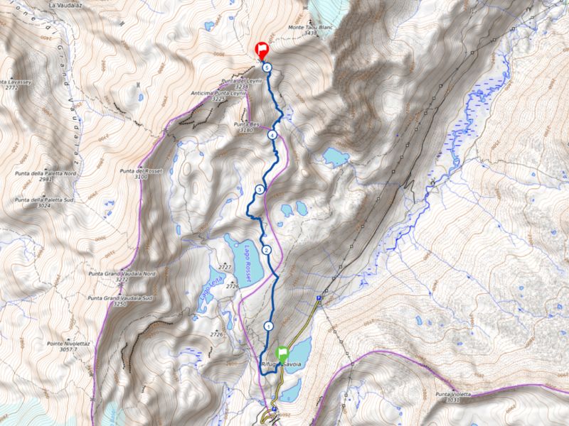
Rifugio Savoia - Col du Leynir
Add to my favorites

Difficulty : E
The characteristics of the route.

Ceresole Reale (IT)
- Distance 5.13 km
- Elevation gain 590 m
- Elevation lost 30 m
- Min. elevation 2538 m
- Max. elevation. 3095 m
- Duration (depending on pace) 2h
- Marking 3 - 9 - 3B
Area : Le Pont
Report a problem
Add your time and share your feelings



Coming to Valsavarenche
Info & contacts
Comune di Valsavarenche
Loc. Dégioz, 166
11010 Valsavarenche (AO)
Tel. (+39) 0165 905703
 Valsavarenche Montagne Sauvage - Parcours - Rifugio Savoia - Col du Leynir
Hello, world! This is a toast message.
Valsavarenche Montagne Sauvage - Parcours - Rifugio Savoia - Col du Leynir
Hello, world! This is a toast message.
Valsavarenche Montagne Sauvage - Parcours - Rifugio Savoia - Col du Leynir
Hello, world! This is a toast message.


OK
Annuler