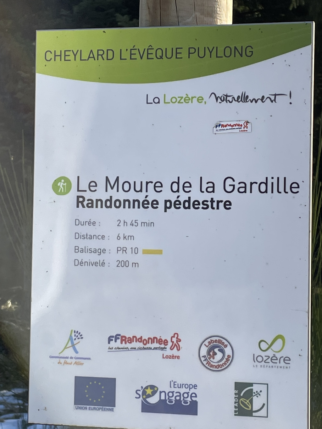
Le Moure de la Gardille
Add to my favorites

Route opened
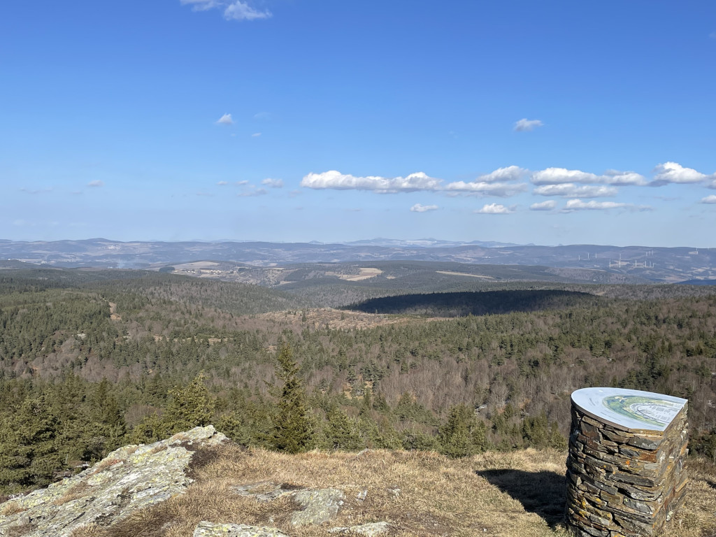
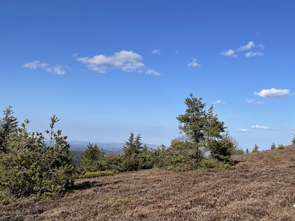
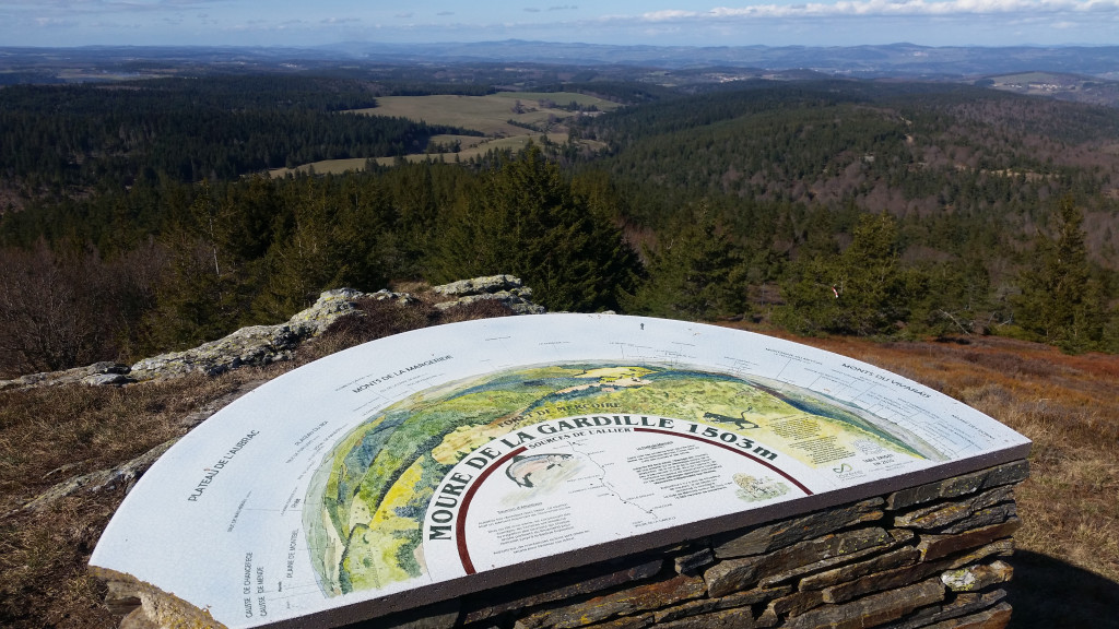
The Roof of the World
Two important springs are located on the mountain, less than 2 km apart: those of the Allier and the Chassezac, which do not feed the same basin. Indeed, the Allier flows into the Loire (Atlantic Ocean) while the Chassezac flows down towards the Ardèche and the Rhône (Mediterranean Sea).
The characteristics of the route.

Lieu-dit Cougnet (48)
- Distance 5.3 km
- Elevation gain 170 m
- Elevation lost 170 m
- Min. elevation 1356 m
- Max. elevation. 1502 m
- Duration (depending on pace) 2h
- Suivre le balisage Yes

- The starting point is the path to the left of the road coming from Le Cheylard l'Évêque. It enters the forest for approximately 350 meters to reach a fork in the path.
- Continue straight ahead on the right-hand path to reach a junction with a perpendicular track (junction with the GR7 trail).
Turn left onto the uphill track. - Approximately 300 meters further on, you will reach another fork; stay on the track and continue straight ahead to the next junction (junction with the GR7 trail).
Turn sharply left onto the track. - Bear right to reach a crossroads (where the GR7 trail diverges and the GR470 trail joins it, leading to the source and gorges of the Allier River: a 3 km round trip).
- At the junction, turn right, pass the summit (1503m), and reach the Moure de la Gardille viewpoint.
- Retrace your steps to the crossroads at point 6 and this time, go straight ahead.
- Continue straight ahead, ignoring any paths you encounter, to return to the starting point.
Parking : Cougnet locality (intersection of 3 roads, 1 of which is paved)
Area : Cévennes et Mont Lozère
Report a problem
Pdf file THIS ROUTE IN YOUR MOBILE PHONE
Download Lozère Outdoor app
Get all the routes on your smartphone with the Lozère outdoor app. You'll find all outdoor activities (summer and winter seasons) and a host of functions :
- Take advantage of detailed IGN maps
- Download data for consultation even when you're not connected to the network
- Geolocate yourself at any time on the route and altimeter profile
- Activate the off-track alarm to be alerted if you stray from the itinerary
- Share your experience (add a report, share your lap time)...

Add your time and share your feelings


Follow us on
the digital trails
the digital trails


![]()
The Lozère Outdoor application was created
by the Lozère Department
Infos & contacts
Conseil départemental de la Lozère
sportsnature@lozere.fr
+33(0)4 66 49 66 32
Crédits photos
 Lozère Outdoor - Parcours - Le Moure de la Gardille
Hello, world! This is a toast message.
Lozère Outdoor - Parcours - Le Moure de la Gardille
Hello, world! This is a toast message.
Lozère Outdoor - Parcours - Le Moure de la Gardille
Hello, world! This is a toast message.


OK
Annuler