Circuit 65. GR®108A Gabas/Col de Peyrelue (frontière)
Add to my favorites

Work on the section between Artouste station and the village of Fabrèges (see the Laruns Town Hall Facebook post)
Route opened
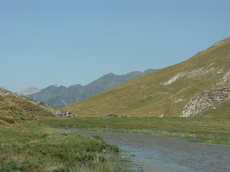
To reach Spain, an alternative to the Col des Moines and Col du Somport is to take the direction of the Brousset Valley and the Col de Peyrelue. This route was used from the 16th century by merchants and pilgrims on their way to Sallent de Gallego and the Tena Valley, as the ruins of an old inn along the way testify.
The characteristics of the route.
Gabas (64)
- Distance 14.7 km
- Elevation gain 910 m
- Elevation lost 100 m
- Min. elevation 1021 m
- Max. elevation. 1853 m
- Duration (depending on pace) 5h
- Marking GR®
You may notice differences between the distance and elevation data displayed on the digital tools and the pdf file due to different data sources.
Report a problem
PDF_Files_Hiking62_Gabas Col de Peyrelue Fiche PDF GR® 108A - De Gabas au col de Peyrelue 2025
Add your time and share your feelings
Services nearby

L'Estibère
GABAS

Restaurant Le Panoramic
ARTOUSTE

Artouste charging station
Artouste
Hébergement Associatif Béarn Pont de Camps
PONT-DE-CAMPS
Refuge de Pombie
COL-DU-POURTALET



Follow us on
the digital trails
the digital trails



The Ossau Valley Tourist Office
Welcome desk of Laruns
Maison de la Vallée d’Ossau – 64 440 LARUNS
+33(0)5 59 05 31 41
Tourist Office
 Ossau valley Land of adventures - Parcours - Circuit 65. GR®108A Gabas/Col de Peyrelue (frontière)
Hello, world! This is a toast message.
Ossau valley Land of adventures - Parcours - Circuit 65. GR®108A Gabas/Col de Peyrelue (frontière)
Hello, world! This is a toast message.
Ossau valley Land of adventures - Parcours - Circuit 65. GR®108A Gabas/Col de Peyrelue (frontière)
Hello, world! This is a toast message.


OK
Annuler